How to keep property stakes locatable in the future?

omni550

Thinks s/he gets paid by the post
Joined
Mar 7, 2004
Messages
3,433
I live in a neighborhood with few fences (which is one thing that appealed to me when I bought my home.)

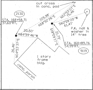
Just to know where the actual property boundaries were, I had a stake survey done ten years ago. The surveyor marked each of the 4 corners of my pie-shaped lot with a 1/2" rebar stake topped with a yellow plastic cap pounded down to ground level.

Recently, a new-ish next-door neighbor installed a chain link fence in the backyard to keep his dogs enclosed, but mistakenly had it installed mostly on my property instead of on the property line. :facepalm: :mad: (One corner of the fence starts near a corner stake, but the other corner of the fence is 2-3 feet on my property.)

To prove to the neighbor that his fence was installed on my land, I needed to find the old stakes. I ended up hiring the original surveyor to come out and locate the stakes, as it was an impossible task for me....trying to find them somewhere near the edge of my lawn after begin covered-up with 10 years of grass clippings and dirt.

So I now can see the yellow caps on the stakes. Is there a simple method that would allow these stakes to be located in the future without having to hire a surveyor? I'm thinking with today's technology (with GPS coordinates, etc..)..perhaps I can get the GPS coordinates somehow and write them on the official survey. In the future, an app or something could then help locate the stakes (after they get buried again under grass clippings and dirt).

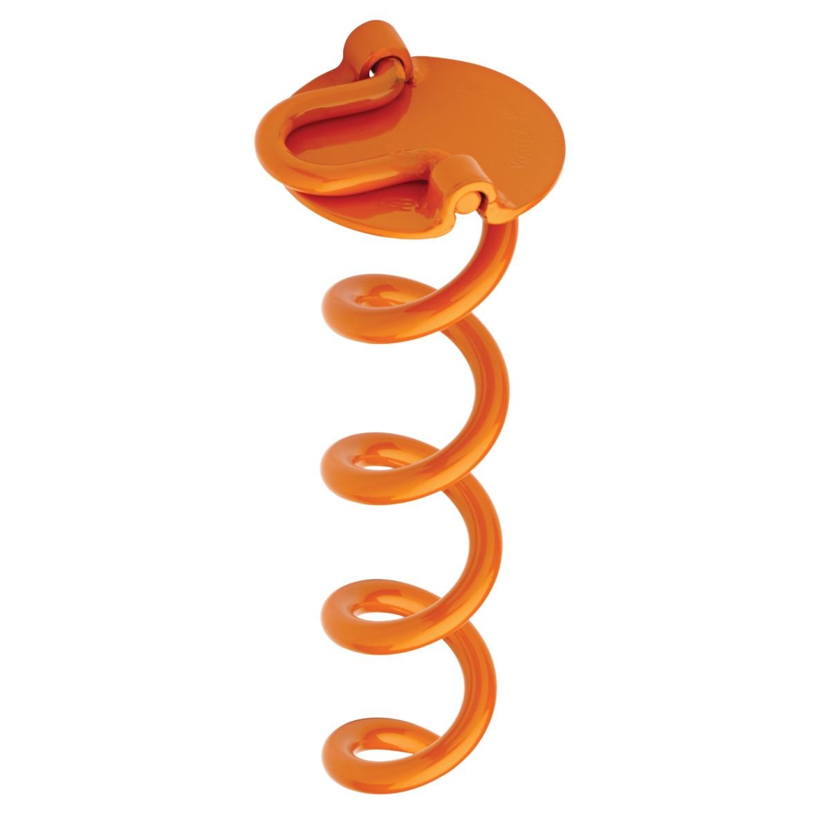
Additionally, I was thinking of physically attaching something to the ground-level rebar stakes that might withstand years of being buried/sitting out in the yard yet be more easily located than a small yellow plastic cap....like brightly colored electric cable perhaps or something else?

Any ideas?

omni
 
Metal detector is how we located them when I worked on a survey crew back in 1996.

You could put a rock on top of them. Or a concrete cylinder or brick/block.
 
Is there a simple method that would allow these stakes to be located in the future without having to hire a surveyor?

A metal detector? Possibly GPS, but you would have to store the coordinates. And have the accuracy to be almost perfect. And, if it was under the ground a few inches, it would still be difficult I think.
 
I have several ideas from my surveying days:

1. Forget about GPS, unless you have survey grade GPS. Anything less would be lucky to get you within 7' of the stake.

2. Some people drive a fence post in the ground next to each of their stakes.

3. Some people drive a pipe over the rebar, leaving it stick out of the ground a little. Inside diameter of the pipe bigger than the dia of the rebar / cap. Pipe is usually about a foot long.

4. Surveyors use a survey grade metal detector to find the stakes and then check measurements between the stakes to verify their correctness. You may be able to rent a metal detector to find stakes if you ever need to do this again.

5. As a last resort, you could make measurements from the stakes to house corners, trees, power poles, etc. If needed later, you could measure your distances from the identifiable objects back to where the stakes were when you measured them originally.


I would probably do no. 3, unless you have fear of someone falling over the pipes, hitting them with mowers, etc.

Good Luck!
 
This isn't a definitive solution, it's just what I did. When I (finally!) located the "pins" at the corners of my lot, I drove a heavy iron pipe into the ground at each spot, then I poured some concrete around each one, about 5" in diameter and a few inches deep, until it was at the top of the pipe, level with grade. I scribbled "NW corner" in the concrete around the northwest corner pin, etc. Yes, these will get covered up with dirt and junk, but they'll be easier to find than the small rusted pins that were there.
Finding the existing metal pins is a >lot< easier if one rents a good quality "magnetic locator." These are lot more precise than a standard "metal detector"--and I finally rented one after digging up about two dozen nails and coins without finding my pins. These magnetic locators are not only more precise, but they can be tuned to be much more sensitive to objects oriented along the axis of the detector (like a vertical piece of rebar) and to disregard spot sources or horizontally-oriented bits of metal (conduit, nails, water pipes, etc).

As far as annotating their location, the surest way is to note each pin's exact distance from two (or preferably three) permanent locations that are not going to move (corner of a house is usually good). You want to get within a foot in the real world so that the person can find the pin easily with a pike/shovel. I don't know if a GPS reading with commonly available equipment would get you to that precision, and it would require possession of a complex instrument. Also, it has to work for many decades, and there could be questions in the future about which datum was used (WGS 72, WGS 84, etc). With a tape measure and identifiable permanent starting points, it should be possible to re-find the pins.

Good luck. I'm sure someone with a more technically correct answer will offer it.

Gonna make the neighbor move that fence?
 
Last edited:
just a side note: if you are looking for the rebar on the strret side of the lot it will be on the edge of the street right of way not necessarily the edge of the street. Either find the original survey or go to the court house and look up the plat to find the width of the street right of way.
In my case they put water meters on the property line as well as light poles which helps.
 
I have several ideas from my surveying days:


3. Some people drive a pipe over the rebar, leaving it stick out of the ground a little. Inside diameter of the pipe bigger than the dia of the rebar / cap. Pipe is usually about a foot long.

I would probably do no. 3, unless you have fear of someone falling over the pipes, hitting them with mowers, etc.

Good Luck!

I would agree with your caution on this one. If there is are any activities going on in your back yard and there are no fences to prevent falls in proximity to these pipes then they would potentially be a tragedy waiting to happen. Personally have seen some very nasty injuries due to 'pipes' protruding inches to a foot out of the ground.
 
I would agree with your caution on this one. If there is are any activities going on in your back yard and there are no fences to prevent falls in proximity to these pipes then they are potentially a tragedy waiting to happen. Personally have seen some very nasty injuries due to 'pipes' protruding inches to a foot out of the ground.

I had one of those tragedies once. While surveying, I tripped and fell, landing on my hands. However, my hand was impaled landed by a rusted, broken off fence post that was sticking out of the ground a few inches.
 
I would agree with your caution on this one. If there is are any activities going on in your back yard and there are no fences to prevent falls in proximity to these pipes then they would potentially be a tragedy waiting to happen. Personally have seen some very nasty injuries due to 'pipes' protruding inches to a foot out of the ground.


Another nasty story of a pipe sticking up.... my brother was running in a yard and with his bare foot stepped on a old rusted sharp pipe sticking up... had a really bad gash on the bottom of his foot...
 
How about taking photos.
When we had the utilities come out to mark, we took photos so in following years we can have a good idea of the locations relative to various things, like sidewalk joint, fire hydrant. etc.

If the corner of the lots is far from the house, a tape measure and a compass will mark the exact spot until the earth's magnetic field drifts too far or flips, but by then you won't care.

Ok, I figured it out, and its really simple. Just measure the distance from 2 points and mark down exactly how far it is from each. Where they intersect is the pin.
See drawing for example.
 

Attachments

  • measure_pins.pdf
    1.5 KB · Views: 32
The simplest way to get close to a corner is to have 2 permanent structures that are some distance apart, and have a distance and bearing to the corner. You can then make two arcs in the location and you should be within a few inches of the corner. When I worked out in the woods, we needed to find old USGS survey corners. For example, in the survey notes, they would describe the marker location and mark 2 trees with a distance and bearing to the corner. We'd find the marked trees and measure off the distance to the marker. A lot of the time, we'd find nothing.

I'd measure from a foundation corner and some other permanent item nearby (even a tree). Where the arcs from them cross will get you close enough to locate the corner marker. If you can find two diagonal corner markers, you can measure from them to find the missing corner too. Worst case is if you have only one, you can make an arc from it and dig along it.
 
Its funny how many neighbors (or is it their contractors) will err by annexing your land. Hopefully, you had a reasonable neighbor who didn't give you a hard time.
 
Ok, I figured it out, and its really simple. Just measure the distance from 2 points and mark down exactly how far it is from each. Where they intersect is the pin.
Right (like I said :), but your drawing helped). Defining the pin's location as a distance from several known points is the easiest way to find it again. Three points is better than two (because two circles will overlap in two points, potentially leading to confusion/ambiguity depending on the situation, but three circles will overlap at just one point). A diagram/map is going to be more useful than simple text, too. And picking the permanent points so that the "arcs" cross at something close to 90 degrees is going to lead to the smallest error in defining the "pin".

Defining the pin using an angle and a distance from a single point is a lot less convenient, since most users will not have a high-quality transit needed to actually define the angle, and the angle must be defined off some other line/point (magnetic north changes over the decades, true north isn't convenient to define without complex electronics, and using another object now requires both objects to continue to exist for decades, or the "plot" is useless). And a good-quality transit really is needed if the distance is more than a few paces.
 
Last edited:
We actually had a surveyor here recently to locate a couple of our corner pins and mark one of our boundaries better (it's a 350' shot through woods). I put an orange fiberglass stake (like used to mark the edges of a driveway for snowplowing) near each of the pins and at certain points along the line.

If you don't want anything visible you could measure from building corners and note the measurements for your records (at least two measurements for each corner). If you need to find the pins you can recreate those measurements and then use a metal detector or a spade to find the pins. GPS isn't accurate enough to be helpful.
 
... GPS isn't accurate enough to be helpful.

Survey grade GPS is, consumer grade is not. Our survey grade was capable of navigating to the head of a nail.


Many of us have mentioned measuring to known points. We used to do that on all highway projects where the pins would usually be destroyed by construction. Here's a couple of drawings to show how the stakes were tied to known points. The filled in black squares are the pins.
 

Attachments

  • Screen Shot 2016-06-03 at 8.08.07 AM.png
    Screen Shot 2016-06-03 at 8.08.07 AM.png
    614.4 KB · Views: 34
  • Screen Shot 2016-06-03 at 8.06.56 AM.png
    Screen Shot 2016-06-03 at 8.06.56 AM.png
    38.3 KB · Views: 217
I would agree with your caution on this one. If there is are any activities going on in your back yard and there are no fences to prevent falls in proximity to these pipes then they would potentially be a tragedy waiting to happen. Personally have seen some very nasty injuries due to 'pipes' protruding inches to a foot out of the ground.

I had one of those tragedies once. While surveying, I tripped and fell, landing on my hands. However, my hand was impaled landed by a rusted, broken off fence post that was sticking out of the ground a few inches.

Ouch!

I bought some of these to anchor an ornamental thingie in our yard. They could work well as markers, no sharp protrusion, and can easily be screwed back down if they did manage to lift up.

51osl-ojv8L._SL1200_.jpg


http://www.amazon.com/Liberty-Outdo...sr=1-1&keywords=Liberty+Outdoor+ANCFR10-ORG-A

-ERD50
 
Ouch!

I bought some of these to anchor an ornamental thingie in our yard. They could work well as markers, no sharp protrusion, and can easily be screwed back down if they did manage to lift up.............-ERD50
My neighbor has these. I move them over into his yard a foot every year. :LOL:
 
Thanks, everyone! I so appreciate the posters here...intelligent and well-informed on so many subjects and so willing to share their knowledge. :flowers:

I guess my dream of easily-located GPS coordinates is still that...a dream. :LOL:

I live in a neighborhood filled with kids, folks walking their dogs, etc. so I am loathe to install anything above ground that might inadvertently cause an injury. Further, the lawn mowing guys need to have clear access.

I'm intrigued by the orange anchors that ERD50 cited. The soil here is heavy clay, so I wonder how difficult they'd be to install?

It appears that a tape measure and several measured arcs from nearby 'permanent' structures is the way to go to find these stakes in the future without added expense. The addition of orange anchors would help, especially if I could remember to 'crank them up' every once in a while to keep them (barely) visible.

And, yes, I am going to politely request that the fence be removed from my property. I see this fence as encroachment which will likely result in adverse possession over time. When I eventually go to sell, I do not want any such issues clouding the property.

My neighbor didn't seem overly concerned when I mentioned that I suspected that his fence was partially installed on my property. I may have misread him, but I get the sense that I may end up hiring a lawyer to send him a letter asking him to move his fence from my property. The Township Building Dept. said they don't get involved with property line disputes, but if it came to filing a court case in civil court, the judge would clearly rule in favor of having a fence installed ON the property line (and not in a neighbor's yard). :nonono:

omni
 
Last edited:
Good idea to get the neighbor to move the fence. In many states, adverse possession exists where a fence not on a deed line becomes a property line after several years.

I'm intrigued by ERD50's orange anchors also. I may have to get some. I don't why, yet.
 
Yes you do need to have him move the fence.
I once bought a property, and the lawyer noted how a neighbors fence was 6 inches on my property in one corner. He warned me that when I went to sell, the buyers could easily insist the fence be moved. (I had already signed the agreement so I was out of luck).
I did luckily manage to sell the property, but only because the market was incredibly hot later and anything with a roof sold fast.

If he hired a company to install it, they should move it for free since it's their fault.
 
I'm intrigued by the orange anchors that ERD50 cited. The soil here is heavy clay, so I wonder how difficult they'd be to install? ...
omni

Clay soil here too (but probably not 'hard clay'), and they went in very easy for me. You can slip a long rod (I think I used a jack handle) through that loop, and they screw right in. Getting the soil moist might help in rock-hard dry clay.

From the reviews, seems the only problem people have is hitting a rock. Unless the rock is very big, just reinserting at a slight angle should be enough to get the point to push the rock out of the way, or move around it.

Note that the loop handle folds flat so a lawn mower won't hit it, yet flips up to tie to, or to help get them installed/removed.

-ERD50
 
Survey grade GPS is, consumer grade is not. Our survey grade was capable of navigating to the head of a nail.....

I concede that you are right but out of 100 posters on this forum how many would have, or have access to a survey grade GPS? My guess is less than one.

Also, from my discussion with my surveyor even the survey grade GPS is not accurate unless there is clear sky above so it is next to useless in the woods or in our situation where the line is adjacent to a large maple tree and next to a cedar hedge. In an open space like you might have for road construction I can see it would be useful.
 
If you truly know where the line is (and it sounds like you do), you would be well withing your rights to ask him to move it. If he refuses, you would be well within your right to remove it and pitch it onto his lot.... so you can tell him that if he doesn't move it by x date that you will remove the portion that encroaches on your property and return it to him... where would he like you to put it? :D No lawyer required... if it comes to that insist that in addition to remedying the problem that he pay your attorney and court fees.
 
Last edited:
I have six pins for an irregular lot. Four at the back boundary are concrete. Two at the front were set by my surveyor 25 years ago.
Last year a new neighbor, before settlement, started to tell me where the fence was going. She was off by two feet. Would not 'listen as I pointed out the marker with yellow cap. After their survey, fence went up maybe 6 inches short of their line. I guess she learned something.
 
Also, from my discussion with my surveyor even the survey grade GPS is not accurate unless there is clear sky above so it is next to useless in the woods or in our situation where the line is adjacent to a large maple tree and next to a cedar hedge. In an open space like you might have for road construction I can see it would be useful.

Your surveyor is essentially correct. Next to useless in dense woods. But we would have no problem getting an accurate position adjacent to a large tree or cedar hedge.

I don't know if the system we used is available nation wide, but our system is a Trimble VRS. Uses US satellites and Russian Glonass, plus a data link to nearby continuously operating reference stations. So it's getting GPS data from roughly 3 times as many sources as conventional GPS. Can only be used where there is a good cell signal and within the range of the VRS system. It doesn't need much of a window overhead in order to get a good fix, and observation time is a few seconds.

Another possibility - opus static gps solutions, where you run the GPS in static mode on a tripod for 15 minutes - 48 hours and the data file is merged with a government GPS file for the same time frame. Accuracy about an inch. No VRS system or cell data link required. All post processed. Need a bigger window overhead for this option - no Glonass satellites used.

So if I were to go through the trouble of getting GPS coordinates on property stakes, I'd go with one of the above methods. But I'd have to go through it all again when I went to find the stakes. Far easier to just measure a few distances from the stakes to some fixed points - house corners, trees, fences, etc when surveying a single lot. But we normally had GPS coordinates on all of our stakes on projects with more than 10-20 stakes, such as highways, pipelines, entire subdivisions.
 
Last edited:
Back
Top Bottom