Good USA Road Atlas

Chuckanut

Give me a museum and I'll fill it. (Picasso) Give me a forum ...
Joined
Aug 5, 2011
Messages
17,280
Location
West of the Mississippi
As much as I like and use online mapping apps, there are times when I want to spread out a physical map on the table and plot my route so as I can get a feel for the distance relationships between places. It's also nice to see what else is nearby and worth a stop.

Can anybody recommend a current USA Road Atlas that is accurate and easy to use? It would be nice if a state could be seen entirely on two pages, with detailed maps on other pages if necessary. Spiral bound would be nice but is not necessary.

Or maybe I should just bet a number of plain old ordinary maps, state by state and/or region by region??

What are your thoughts?
 
I use a Rand McNally large print atlas. Started the large print in the last couple of years :) It has the state maps and small insert maps of large cities. I prefer reading an atlas and planning a trip it.
 
I just picked up the Rand McNally 2016 road atlas at Walmart. Not spiral bound, but has the states on 1-2 pages each with detail pages of the cities.

I'm still going to get some state maps for the states I need better detail on.

I like having the atlas for general planning and detailed maps for when we hit the road.
 
I like having the atlas for general planning and detailed maps for when we hit the road.
^ This is the best solution. I've never seen a commercially available atlas with the detail available on individual state maps - probably due to weight limitations. :)
 
Even though I have a great GPS , at times I also feel like I'm driving blind as I have no idea where in the world I'm currently at relative to other things.

So far my solution has been to stop at the Welcome Center and pick up a State map to keep in the car.

I do plan trips on the computer at home to get a very high level view of where we will be travelling and adjust to see sites or avoid cities.
 
Road Atlas? What's that:confused:

+1

I keep an old Rand McNally atlas in my car, in case the interstates are jammed and I need to use the back roads during a hurricane evacuation. Otherwise I just never travel far enough to get lost. :blush:

Honestly I haven't used it for over ten years. It was a pretty decent atlas for the time, IIRC. I am not familiar with any other type of atlas.

I have an iPhone now so that's another option in case I get lost on a hurricane evacuation. Never had or used a GPS. Never go anywhere unfamiliar enough that I would get lost, normally.

If I wanted to plan a trip (I don't!), I'd just do it on my laptop using Google maps. That gives me a lot more access to information about things I might see along the way, than my old atlas would.

Re-reading this post, my life probably sounds SO boring to most people! :LOL: It isn't to me but it sure sounds that way. Oh well!
 
Last edited:
I just bought a new one a couple of weeks ago. The previous copy (always carried in the car) was in sad shape after only about five years.

Rand McNally 2016 Large Scale Road Atlas

I also got one of these to go with it. A great way to see what's coming up (as long as you have a navigator on board to read it for you):
the Next EXIT 2016 (Next Exit: The Most Complete Interstate Highway Guide Ever Printed)

Looks like the 2017 edition was released 10 days ago. Time for a trip to B&N, as I need one I can actually read for the car.

http://www.amazon.com/McNally-Large...d_cp_14_3?ie=UTF8&refRID=07G2YV85BBB3SVWTN5D4
 
DW has map phobia. I used to use yellow marker on the map and use post-it stickers to show points on interest and destination. This was still generated a lot of frustration and tears.

Today, I just ask her to enter next point of interest in her iphone and let it tell us how to get there. No more tears.
 
The atlas is a great resource to have, but I still prefer having local maps, at least in biggish cities where the traffic can be unpredictable. Being able to pull over and find alternate routes is so much easier than trying to convince a GPS to tell you where to go. Technology is great, but sometimes analog still kicks @ss.
 
Brings back memories of owning the big Rand McNally atlas.

Then afterwards, using Delorme or Microsoft Streets and Trips software to print out pages and pages of turn by turn maps...so high tech at that time :).
 
We've used Next Exit for years. Very good companion if you drive interstates frequently.
 
The atlas is a great resource to have, but I still prefer having local maps, at least in biggish cities where the traffic can be unpredictable. Being able to pull over and find alternate routes is so much easier than trying to convince a GPS to tell you where to go. Technology is great, but sometimes analog still kicks @ss.

My new GPS (retails about $450) is bigger and generally much better than the old one.
However, when I miss a turn, the old one would complain "re-calculating" and this would allow me the chance to stop, backup/u-turn and fix the issue.
This new one just lets me miss a turn and later says "turn x in x distance" as if nothing wrong has happened.
Makes me look smarter :LOL:
 
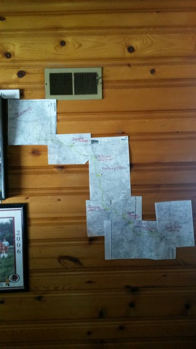
DW's friends put this map together for their last trip planning. Then rolled it up and took it with them for navigation. Worked perfectly.
 

Attachments

  • IMG_0885.jpg
    IMG_0885.jpg
    360.8 KB · Views: 34
People still use an actual paper road atlas? That is so old school.
 
I have and use a Rand McNally USA atlas. Not only is it helpful for finding campgrounds, points of interest, and potentially interesting alternate routes, it is also a great time waster on long trips without much to do. I am a map lover, though, and never tire of flipping through to look at states I've yet to see, or remember ones I've been to.
I collect country maps from all of our trips and also have a huge wall map full of pins detailing our travels.
 
and also have a huge wall map full of pins detailing our travels.

We have a full size interactive map of the world right outside our door. ;)
 
People still use an actual paper road atlas? That is so old school.

GPS is only useful if you know where you want to go. I've been sitting in stand still traffic in a strange city, and the GPS has been totally useless. I would have killed for a paper map so I could cruise the back roads and alleyways to work my way through. It's also a pain to try to get a GPS to take the road less travelled. Now I try to have an atlas for the highways and a detailed paper map for the cities. It's also great for pre-planning a trip. Printing out Google maps just doesn't do it.
 
We have an older GPS, a car with a Nav system, my DH has an Iphone 6 and he was just saying that he would like to have a map. We are going back on our schooner trip in ME again and we would like to go a different way and see different things. We would like to get off of the interstates this time. That large print atlas looks perfect!
 
Thanks. I picked up the spiral bound Rand-McNally Atlas for home use. For the car, i will bring more compact folding maps.
 
Rand-McNally Road Atlas? Oh boy, I bought one years ago, but have not used it for so long I don't know where it is now (I know I would not throw it away).

For extensive RV'ing, I have been using map software on a laptop, plus Google map on an iPhone. I cannot see planning a cross-country trip on a handheld GPS or a phone, so a laptop software is a must for me. Handheld devices are good for exploring into towns, however.

Active RV full-timers who boondock a lot buy Delorme Topo paper maps so they can go off-road. And for hiking, you would need detailed trail maps.
 
Back
Top Bottom