OP
OP
TromboneAl
Give me a museum and I'll fill it. (Picasso) Give me a forum ...
- Joined
- Jun 30, 2006
- Messages
- 12,880
Well that changes everything! I mean, if you have a lighthouse mailbox, you just have to have a jetty!
More seriously, when did the 'jetty'/debris go in? Did it start small and grow, or
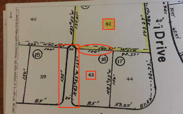
Is there any chance at all that the drive was actually 8' over on his property, and he is just trying to reclaim what is really his? Seems unlikely, but can you rule it out?
edit - sorry, cross-posted with JoeWras on the 'need' for a 'jetty'- still would like to know about timing and survey marks.
-ERD50

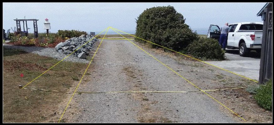
Pretty clearcut the rocks are on the driveway. The fence here is supposedly on the border:

He had rocks delivered. I thought he was going to put them around his foundation, then we went out and they had been arranged. IOW, all at once.
Last edited: