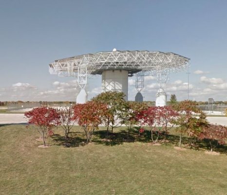
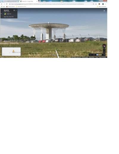
I have attached a Google Street view of a structure that is located NE of Downtown Dallas. We saw it when driving down I-35E. An overhead view shows it to be on its own piece of ground (not in the parking lot in the picture), with an easment drive to it (but no signage at the end of the drive). It is near a place called Gas Monkey Garage, which I understand to be a restaurant.
I'm more interested in knowing its purpose, rather than who owns it.
Any help/guesses out there?
I'm more interested in knowing its purpose, rather than who owns it.
Any help/guesses out there?
")