Any GPS experts here?

A Visitor

Dryer sheet aficionado
Joined
Oct 24, 2006
Messages
32
I've been looking at them for a while, leaning toward Garmin or Tomtom. Now my son can get me a Magellan 4350 for $240. It looks like it has some higher-end features like multiple destination sorting, lane guidance, FM transmitter (and a few I don't care about), and the reviews seem favorable. Unfortunately no voice recognition but at that price I guess I can't have everything. I'm a little concerned that routing may not be as accurate as Garmin or Tomtom. Any advice?

Thanks...
 
I have a garmin nuvi, my sister a tomtom. They seem to be the leaders - and definitely have superior mapping sw. Both are recommended by consumer reports as well

Screen size makes a big difference.

Check cnet reviews for detailed reviews.
 
I'm not an expert. The only constructive comment I can make is that I'm delighted with my Garmin Nuvi 350.
 
I'm happy with my Magellan 5310. Only use it for point A to point B stuff. Can't comment on the 'congestion ahead' kind of thing.
 
Can't comment on the 'congestion ahead' kind of thing.

The 4350 has the traffic receiver but I don't know how much the subscription costs. I doubt if it's worth it for me. One kinda cool feature though is that if you are on a freeway and your speed drops well below the limit, it assumes you are in a traffic jam and starts displaying alternate routes...

Whoa - I'm a dryer sheet wannabe already:confused: I always wanted to be a dryer sheet wannabe! Hooda thunkit!
 
My nuvi is 2 years old and came with a 1 year free subscription to a MS traffic application. This never worked well, and if it is important I would be sure to verify before purchase.

The voice directions are quite helpful - I don't have to look at the screen while driving.
 
The ones with a male voice are more reliable.
 
I love my Nuvi 660. I just updated the maps, it cost $69. I don't subscribe to the traffic stuff, not enough traffic to worry about. :)

You can chose the voice, male or female. I chose Mrs. Garmin.
 
Strange as it may sound, but the best GPS I had was my Samsung SCH-U740 phone and Verizon service. The GPS locked in 10 seconds even while I'm indoors, and the directions and street names are always up to date because they reside on Verizon's servers. Since the summer of 2008, Verizon also threw in traffic monitoring for free. Because the GPS and phone are combined, I never forget to have my GPS. For long trips, I had a car charger that I bought for $20.

Unfortunately, I upgraded to a Samsung Blackjack 2 with AT&T service, and its GPS sucked so bad that I had to go buy a separate GPS. The Blackjack 2 took 5 minutes to lock even while I was outside. I bought a Mio Walker for $89, and it's the only one in that price range that can pronounce street names. The lock time is acceptable, but some off ramps and connectors are pronounced as "a no name road."
 
I'm not an expert, but I have been using GPSs for almost 10 years. I have a Garmin GPS V and a Garmin GPSmap 60Cx. I love them both. They are designed to be portable, weather proof. They use AA batteries. No voice, no traffic, no touch screen.

If you're new to GPSs, be aware that they are not perfect. Their main function is to tell you where you're on earth. Everything else is just programming based on the data fed to them (map databases). So, if sometimes, they tell you to make an incorrect turn, it's not their fault, it's the database provider's. And it's takes a while to familiarize oneself with the way they work, and to trust them. They do make mistake every now and then, but most of the times they are right.
 
My buddy just got the Crackberry Storm from Verizon. The GPS (subscription required) is incredible. It gives a Google Earth-type view if his house, with a dot inside it showing where he was. When he walked across the room, the dot followed. Amazing precision.

That said, I bought a refurbed Navigon from TigerDirect last Christmas for $79. It gets me where I need to go. It had a free map update included. Unless you just really like to play with the tech I wouldn't go for all the various bells and whistles.
 
We have a Garmin Nuvi 785T and a Nuvi 680. The 680 is a couple years old (and discontinued) but was worth its weight in gold while we used it (now that I think of it the $900 purchase price was a bit steep... Gold-like). Both of these models have the MSN Direct feature -- I have found that the "local gas prices" alone pays for that.

The 785T (paid around $600) is the best thing since sliced bread. We drive in a lot of strange places (25,000 miles since last July in our RV, for example) and the "lane assist" is something I (now) cannot do without. Large cities like Chicago or Dallas/Fort Worth (actually anywhere in Texas) seemed to have designed their inner-city highways specifically to confuse me. I was always in the wrong lane and spent considerable time getting "back on course" before getting the 785T.

Another thing I like about the 785T is that the speed limit is always visible. All those panic thoughts about having missed the road sign -- "Yikes! What is the speed limit here... 55, 60, 65, or 70?" This is even more important within city limits. (I have found this to be about 95% accurate, BTW.) Along that same line, the GPS seems to be much more accurate than the speedometer.

The "cookie crumb" feature is another wonderful addition. This helps when you travel on those "off the map" backroads that seem to be everywhere now days. It is comforting to know that you can simply retrace your route to get back to civilization.

The "routing" feature is probably valuable but, to be honest, I use MS Streets & Trips for that.

The Nuvi 885T is the same as the 785T except that it is voice-activated (same price even). I would have preferred that but couldn't wait for the release date -- which occured this week.

I am not sure I have helped with your decision. In any event, the mapping is, actually, determined by the programming (Mapquest, Google, Microsoft, etc) and not by the GPS unit itself.
 
my vehicle has one installed which i can't stand so i bought a portable one last year. did quite a bit of research b4 finally getting a tomtom one xl s. it's not the most high-end one out there but it works great...have no complaints.
 
The Nuvi 885T is the same as the 785T except that it is voice-activated (same price even). I would have preferred that but couldn't wait for the release date -- which occured this week.

I am not sure I have helped with your decision. In any event, the mapping is, actually, determined by the programming (Mapquest, Google, Microsoft, etc) and not by the GPS unit itself.

Ron, looks like a great unit but well beyond my price range. As far as lane assist, I have in mind those awful rotary things in NJ where you have about 8.2 microseconds to make your move. Thanks for the feedback...
 
Tomtom and Garmin both make specialty ones for motorcycles that are waterproof and have bigger buttons for gloved hands. They are (to me) grossly overpriced so I'm thinking of buying a cheapo, defined as less than $100, and simply regard it as disposable if it succumbs to rain or vibration.

The idea is that I can just go for a long ride "following my nose" and then when I want to go home just turn on the GPS.
 
I have a Tom Tom XLS that I got as a birthday present . Do you think my SO was trying to tell me something ?
 
I have a Tom Tom XLS that I got as a birthday present . Do you think my SO was trying to tell me something ?

We do have a Garmin 230 and enjoy it. The device has ended all of those discussions about "you're going the wrong way" or "it would have been nice if you had pointed out the turn before we reached the intersection".

So at least one source of marital discord has been resolved by modern technology.:whistle:
 
....,snip>..........................

So at least one source of marital discord has been resolved by modern technology.:whistle:

I'd second that. My DW hates to play navigator and quickly loses interest at the most inopportune times. I just keep an eye on my progress on the Garmin and she reads merrily away.
 
I bought a megallan for about 150 bucks. For me, it's good when I have to look for a specific address in a local area. It speaks to me, looking at it on the road is dangerous, business, so it verbally signals me to prepare for turns.

If I get a bit confused, I stop and look at it to reorient myself. If you want all sorts of bells and whistles, buy something for about 100 bucks more, but I prefer simplicity, and the price just keeps getting lower and lower.

Runs on car plug and keeps charge for a few hours, can disconnect it, put in pocket, walk around town, and turn it on when you get lost.

jug
 
Jug, I take it you are happy with the Magellan's routing accuracy? That was my main concern with it. Any feedback on cost of map updates? Oh, and do you use any of the AAA features? I'm an AAA member so that looks like it might be a minor additional benefit...

Thanks...
 
i-phone. there's an app for that. It even works, mostly, though it's too small, sucks the life out of the battery post hasty, and the left handed navigator has a tendency to say right when the other 93% of the world would read left. It's her right. Also, the app cost nothing, and if in need of confirmation we can call up Google Earth and see what the local landmarks are.


YouTube - iPhone 3G GPS Road Test

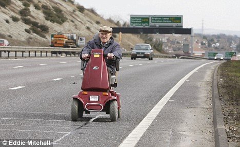
Me before GPS:
 

Attachments

  • article-1156853-03AFEDFC000005DC-963_468x286.jpg
    article-1156853-03AFEDFC000005DC-963_468x286.jpg
    45.8 KB · Views: 2
Amazing how far [-]satellite navigation[/-] GPS has come. Early seventies on board the research ship RV Vema, we had an antenna mounted on top of the mast, sucker weighed about 80 lb, had radials and a vertical sticking out of it for 3 feet. The receiver was 19" rackmount classified device with seals on it. With all sorts of rules on who can see it.

The pre-rocessor was another rackmount with about 40 plug in cards with discreet transistor flip flops, outputting data to a Freiden tape punch. Which produced typically an 10 foot long tape with holes in it representing the satellite orbit, ID, time etc.

To actually get the data, the receiver's speaker was always on. THe watch standers in the electronics lab had trained ears for the faint whistle, of the satellite coming up the horizon. When heard the nearest tech would leap to the control head and press the oscillator tune until the local oscillator matched the satellite doppler, and lock onto the signal. Then the receiver would track the doppler shift until the satellite disappeared over the far horizon.

During the satellite pass the Frieden punch would be clankin out the the punched tape with the satellie data.

At this point all we knew was that we had sat. data.

Now came the processing part. The good old DEC PDP8 with 2 Kilobyte of memory was standing by, or running some other program. We set the toggle switches on front panel to tell computer that it is to expect a program. Now, feed the program tape int the reader, hit the go paddle (switch), and the machine would read a punch tape with the proper holes, which had the satellite navigation program.

This completed, the PDP 8 would beep,indicating it was ready to accept data. Now we loaded the previously punched data tape ftrom the last satellite pass, hit the go toggle, and for 20 ro so minutes be rewarded with an entertaining sequence of flashing lights on the front panel as the computer was processing the data.

At the end of twenty minutes or so the winking blinking lights would stop for a moment, then the computer started to output the fix (our location) on a teletype machine. with a great amount of clanking.

THus we received four lines of data with latitude, longitude, confidence level and estimated time of next satellite pass. The fix was typically good for a 10 to 12 mile radius.

After all this we walked over to the chart table and plotted our location. And got on the intercom to the bridge and read them the fix.

Anyone for the good old days:confused:??

I now have a laptop in my suburban with Street Atlas, a surplus Rockwell GPS receiver, a puck antenna on the roof and can navigate on the go.

I like this newer version better.:D
 
I am perfectly happy with my Magellan...all but the brand new developments are on the supplied maps. It cost about 125 bucks 2 xmas's ago, and ive used it daily to find new addresses....fwiw
 
I ended up getting very low end Garmin and Magellan units for various household members for xmas. We did some extensive head -to-head comps and both passed, so it became personal preference and other features that mattered more than the mapping and routing. Garmin has a better trip simulator making it easier to preview and customize the route
 
Back
Top Bottom