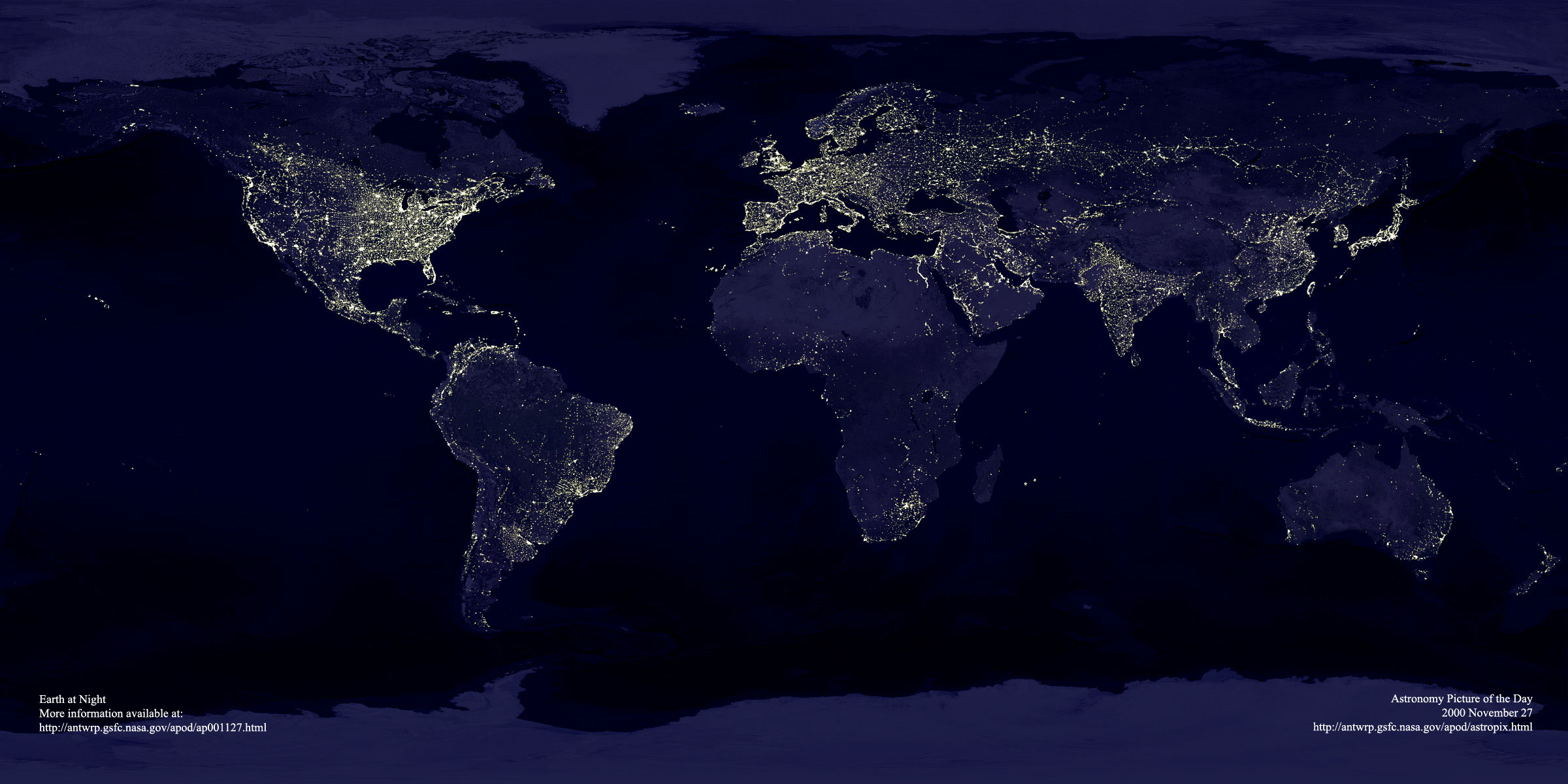
This great image has been around for many years, it's a composite of visible images from the Defense Meteorological Satellite Program (DMSP) satellites. Those satellites are nearing the end of their lifetime, and are to be replaced with the NPOESS system, that combines DoD and NOAA satellites.
Although DMSP was not intended to produce this type of image -- it was basically a weather satellite -- it has proven valuable because of its imaging capabilities and its long legacy in space. This has helped it to support studies on environmental changes, population shifts, etc.