GPS

Civilian GPS receivers do have some legal limitations put on them: they are limited to altitude less than 60,000 ft, and velocity less than 1000 knots. This is so that they cannot be used in missiles. This is known as the CoCom limits, and is not the same thing as the reduced accuracy inherent in the civilian GPS signal relative to the military signal.

One thing GPS users may not realize is that GPS accuracy is not a static value. It changes with location and time too. That is because the GPS satellites are not geostationary, but circle the earth roughly twice a day.

It is not the same as the poor coverage of your cell phone signal. If you get poor cell phone signal strength in a location, it will remain poor until the carrier puts up another cell tower. In contrast, while standing still in one spot, you can have a bad GPS signal condition, which then clears itself up some time later as some new satellites cross the sky to replace the ones that drop below the horizon. The receiver needs signals from a minimum set of 4 satellites to compute its position. Occasionally it may get as many as 12 satellites. The accuracy of course improves with the number of redundant signals.
 
Last edited:
I never like carrying a second device. I have a Samsung galaxy III smartphone. It has Google navigation which works very well. I also installed the Co-Pilot navigation application whick keeps all of the maps on the phone. This is just in case you lose phone connection which would stop google from working.

I have been using my iPhone as a GPS device with great results (Navigon app). We crossed the US with it and it helps me navigate through the Bay Area. No complaints.
 
I have a Garmin nuvi, model unknown, which came in handy in Portland, OR recently. For more casual use, the iPhone GPS works well, but NOT while driving...
 
I have been using my iPhone as a GPS device with great results (Navigon app). We crossed the US with it and it helps me navigate through the Bay Area. No complaints.
Out of curiousity, what do you if you are out of cell phone reception?

Also how do you rig up the audio and video? Do you pipe the Iphone audio into your car speakers and the video into a car display?
 
Out of curiousity, what do you if you are out of cell phone reception?

Also how do you rig up the audio and video? Do you pipe the Iphone audio into your car speakers and the video into a car display?

There have been plenty of times when we were out of cell phone reception (going through Wyoming and Nevada), but the GPS kept on going - like it would with a Garmin or Tom-Tom.

You can pipe in the iPhone through the car audio system if you want, but personally I can hear the turn-by-turn instructions coming from the iPhone just fine (I don't have to watch the map very often). I mount the iPhone on the dashboard like a regular GPS unit (my car does not have a display ;)).
 
Last edited:
The Garmin Nuvi line is popular and very good, on some models they offer lifetime map updates for an additional fee.
At Costco, this comes with lifetime maps? I think the voice-recognition Nuvi Garmin we bought lately came with lifetime maps, and it was way cheaper than any Garmin car GPS we had bought before.

The voice recognition works amazingly well. This is the first car GPS in a long time where I have been happy with the user interface (UI). For many years, Garmin seemed to have been going backwards with their user interfaces and performance, causing much annoyance on our part. I'm so glad Garmin finally turned things around.

I suspect the competition from smartphones with GPSs and iPads with GPSs has forced Garmin to both become much more aggressive with their pricing, and to significantly improve their UI. It's about time!
 
Last edited:
Talking about GPS accuracy, while the civilian GPS devices do not have the accuracy of the military GPS units, the restriction is not something that can be circumvented by the civilian GPS receiver makers. See: GPS signals - Wikipedia, the free encyclopedia.

Basically, the military units receive a different GPS signal altogether. And in order to receive that signal, the receivers must incorporate some very special hardware that is controlled by the US DoD. And on top of that, before use the receivers must be loaded with a time-limited crypto key. That prevents the use of the receivers if they fall into enemy hands.

PS. The civilian GPS signals can be turned off altogether in war time if so desired, although that would cause major disruptions, hence somewhat unlikely now. Or the signals can be degraded to introduce higher errors as wanted.

PPS. The US DoD does allow friendly nations access to the military GPS accuracy. Here's how you would apply to get the special hardware that would be needed: International Programs Security Handbook: Appendix H. ;)

Of course, if you do not get the crypto key renewed periodically, your receiver would be useless in time. You have to play nice, or no GPS for you! See, it's all in the open ;)

That's why Europe decided to put up their own independent system. The 4th satellite was launched about 10 days ago.

BBC News - Galileo: Europe's version of GPS reaches key phase

We have had a Garmin nuvii for a few years and use it in North America and Europe. It works great for the most part but we always carry maps as well.

We also have a hand-held Garmin GPS for hiking, although it can be used for driving as well, but no sound.
 
I think the iPhone and Android GPS apps are like cameras in cell phones--of course a dedicated GPS or camera can be found that will do much more, but for my purposes, the gps and camera apps on my phone have been more than adequate and are always at hand.
 
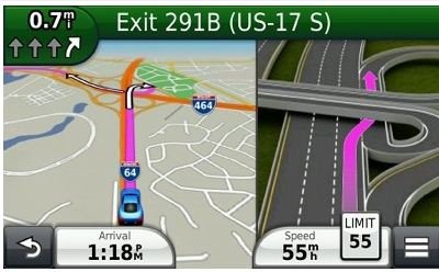
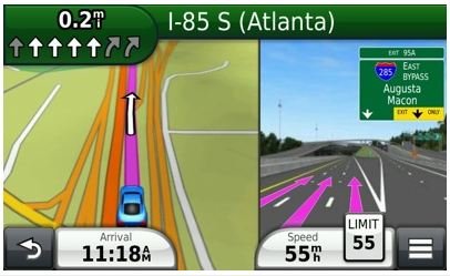
This Thread is USELESS without pics......

:greetings10:

Garmin-1.JPG

Garmin-2.JPG

Actually, I am submitting these to find out if this is available on the above mentioned cell phone devices.
 
:greetings10:

View attachment 15266

View attachment 15267

Actually, I am submitting these to find out if this is available on the above mentioned cell phone devices.

That looks pretty similar to what I get with Navigon on the iPhone (including the invaluable speed limit reminder). Maybe I can try to get a screen shot later today*.

*Edit: actually there are already plenty of screenshots available online. Google "navigon iphone screenshot".
 
Last edited:
I would also recommend checking out cell phones as a possibility, depending what your needs are for GPS. I've been using an app called Waze on my iPhone, which will read the directions to you, and also compare routes with current traffic to help you avoid traffic heavy areas. I've heard there's an app by TomTom, but I think it's pretty pricey.
Having a nav system in our 6 year old car, whose maps are $300 to update, I'll never pay extra for a car with nav again, and highly prefer having a generic device that I can easily switch between whatever is the best app at the time.
 
Actually, I am submitting these to find out if this is available on the above mentioned cell phone devices.
Yes there are lots of them, some come with the phones, and they provide turn-by-turn maps with voice guidance. Garmin even sells a smartphone GPS app.

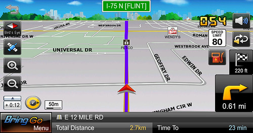
And evidently some carmakers are going one better, displaying your smartphone GPS screen on the car's center stack screen (image below)...http://www.nytimes.com/2012/10/12/a...ntroduce-smartphone-gps-connections.html?_r=0.

One day your smartphone will do everything but breathe for you, I'm looking forward to it...

7698004674_90a22d57aa.jpg
 
Last edited:
I looked at all the options before our trip to Sicily last summer.
Cell phone wasn't practical because we were going to some places with no reception.
We chose Tom-Tom over Garmin because every review I read *specifically* about maps in Sicily said Garmin's maps were inadequate. I will tell you that Tom-tom did fine... even on windy little alley's (vespas and feet only) in Modica, and on unmarked roads through farm fields just east of Marsala. Sicily does not really do a lot of road maps or even street addresses. Our vacation rental in Marsala didn't have a street address - just GPS coordinates.

I use my phone for around town, here in San Diego... When we were doing a national park tour of Glacier/Yellowstone/Grand Teton - we were glad we had the Tom-tom, rather than just our phones. Lots of places in Yellowstone and MOST of Glacier was completely cell reception free. In yellowstone you'd find signal near old faithful, or by the Canyon complex... but not so much when you were between the areas.
 
Talking about GPS accuracy, while the civilian GPS devices do not have the accuracy of the military GPS units, the restriction is not something that can be circumvented by the civilian GPS receiver makers. See: GPS signals - Wikipedia, the free encyclopedia.
Are you sure this is up to date? I thought President Clinton ordered the "selective availability" feature (i.e., degraded signal for civilians) to be turned off in 2000, partly because the Cold War was more or less over, partly because (I've heard) military units were hard to come by and US troops were buying their own civilian-grade units. Maybe a forthcoming version of GPS will once again introduce a military and civilian distinction. Or maybe I missed something, as usual. :)
 
Yes there are lots of them, some come with the phones, and they provide turn-by-turn maps with voice guidance. Garmin even sells a smartphone GPS app.

And evidently some carmakers are going one better, displaying your smartphone GPS screen on the car's center stack screen (image below)...http://www.nytimes.com/2012/10/12/a...ntroduce-smartphone-gps-connections.html?_r=0.

One day your smartphone will do everything but breathe for you, I'm looking forward to it...

7698004674_90a22d57aa.jpg

This graphic doesn't tell one which lane to be in nor the number of lanes from which to choose -- note the images I posted.

I am unsure here. Maybe I need to familiar myself with what turn-by-turn maps are. (Not saying this isn't an apt description... just that I need to make sure we are speaking of the same thing as live tracking.)

I don't know what a Car's "center stack screen" is.

"A better, safer solution would be to feed a phone’s maps and instructions through the car’s larger, built-in display and sound system."

How is this safer than being placed in your field of vision? I never have to take my eyes off the road (well. you know what I mean -- not look away). And yes, I can pipe the sound through the vehicle's speaker system -- I elect not to but it is an option.

Nevertheless, I don't really don't have a dog in this fight. My praise is for GPS per se. Whether it is on a laptop with MS S&T, a Smart Phone, A Tablet, or a dedicated GPS unit (in-dash or not) is not important to me (all, BTW, devices I have and use extensively). The Garmin device I use is the result of many years of personal experimentation to arrive at what is most comfortable for me and YMMV.

Truth be told, I enthusiastically support anyone's navigational choice... well, paper maps are down the list, I guess.
 
Last edited:
Cell phone wasn't practical because we were going to some places with no reception.

With most GPS apps, cellular reception is not required for the GPS to work (just like for a dedicated GPS device).

For the app I use for example:

NAVIGON MobileNavigator carries the complete map material within the phone. The app relies on the GPS receiver, independent from a cell or wireless signal, providing directions and recalculations even when no cell phone signal is available.

No cell phone reception, no problem.
 
Last edited:
That's why Europe decided to put up their own independent system. The 4th satellite was launched about 10 days ago.

BBC News - Galileo: Europe's version of GPS reaches key phase
I first heard of the Galileo proposal many years ago, but have not been following up on it (well, that happens when you drop out of the business).

So, I looked at the link and learned that the first 2 Galileo sats were launched last year, and with the two newly launched satellites, they now have the minimum of 4 satellites for a ground receiver to be able to compute its position. However, the window in the day when all 4 satellites are in view for test is fairly short. And that only happens at a small preplanned area on earth.

This situation was similar to the US GPS system, back in the early 80s. There were only 5 or 6 NAVSTAR satellites up then, with their orbits arranged such that Yuma Proving Ground got a coverage of an hour or two each day for testing. And as that window slowly slipped from day to day, people had to work according to that schedule. And that meant working night or early morning. :)
 
Smart phones have GPS chipsets which can tune into GLOSNAS, the Russian system, and maybe Galileo as well.

Plus with A-GPS from cell towers, it's more accurate.

But now, you can ask for directions through Siri. Google also has their equivalent, called Google Now.
 
Are you sure this is up to date? I thought President Clinton ordered the "selective availability" feature (i.e., degraded signal for civilians) to be turned off in 2000, partly because the Cold War was more or less over, partly because (I've heard) military units were hard to come by and US troops were buying their own civilian-grade units. Maybe a forthcoming version of GPS will once again introduce a military and civilian distinction. Or maybe I missed something, as usual. :)

It was true that during the first Gulf War, many US troops had to buy their own Trimble GPS (one of the 1st civilian GPS makers).

However, the C/A and P(Y) signals as described in the Wikipedia article are still in use as we speak. Let me explain further.

S/A or Selective Availability was the intentional degradation of the civilian C/A code, and it was indeed turned off in 2000. Back when S/A was on, the position output was god-awful, but GPS receivers were expensive and not in wide use, so not too many people remember this. They dithered the signal, so that the GPS receiver position output would jump around a few hundred feet.

Now, with S/A gone, using just the civilian GPS signals, one can get down to a few meters (subject to all the caveats I explained earlier), which is quite good for most purposes. By using the military signal with the special receivers (which must be loaded with crypto key), one can squeeze out a few more meters of errors.

However, the real advantage of the military GPS receivers is this: 1) they are more tolerant of signal jamming by the enemy due to the use of the P(Y) code, and 2) when GPS signals are denied to the enemy (who are using civilian GPS receivers), the military GPS receivers will keep on working. How and why?

The old and obsolete S/A was a global degradation "feature". There are ways to deny GPS signals to a smaller localized area of conflict (talk of conflict, I can think of guys running around and hiding in the mountain ;) ). In fact, here's a statement from the US Government made in 2003 (Reference: GPS.gov: Special Notices Regarding GPS Selective Availability)

The United States Government recognizes that GPS plays a key role around the world as part of the global information infrastructure and takes seriously the responsibility to provide the best possible service to civil and commercial users worldwide. This is as true in times of conflict as it is in times of peace.

The U.S. Government also maintains the capability to prevent hostile use of GPS and its augmentations while retaining a military advantage in a theater of operations without disrupting or degrading civilian uses outside the theater of operations.
 
Last edited:
This graphic doesn't tell one which lane to be in nor the number of lanes from which to choose -- note the images I posted.

I am unsure here. Maybe I need to familiar myself with what turn-by-turn maps are. (Not saying this isn't an apt description... just that I need to make sure we are speaking of the same thing as live tracking.)

I don't know what a Car's "center stack screen" is.

How is this safer than being placed in your field of vision? I never have to take my eyes off the road (well. you know what I mean -- not look away). And yes, I can pipe the sound through the vehicle's speaker system -- I elect not to but it is an option.

Nevertheless, I don't really don't have a dog in this fight. My praise is for GPS per se. Whether it is on a laptop with MS S&T, a Smart Phone, A Tablet, or a dedicated GPS unit (in-dash or not) is not important to me (all, BTW, devices I have and use extensively). The Garmin device I use is the result of many years of personal experimentation to arrive at what is most comfortable for me and YMMV.

Truth be told, I enthusiastically support anyone's navigational choice... well, paper maps are down the list, I guess.
I wasn't trying to convince you of anything, I was simply answering your question. If you want to buy a dash mount for a smartphone that's fine (not everyone does), but many have such small screens, you end up relying mostly on the voice guidance (at least I do, I don't look at the display as often). If you prefer Garmin, great, I think they're great products...
 
DW has a garmin nuvi and loves it. I've worked 20 some years in the gps industry but I don't use the nuvi - just my phone. It gets me where i need to go. The gps navigation world needs an upgrade. The problem isnt the accuracy of the gps - its the makeup of the address geodatabase that couples with gps in providing directions. Many of us have seen that a navigational gps gives us "wrong" directions. The error is due to approximations in the algorithm that translates the user's desired address or poi to latitude and longitude coordinates that the gps understands.

I use survey grade gps at work that in conjunction with data link to continuous operating reference stations yield accuracies of approx 1/4 inch horizontal. Makes planning/design/survey of long highways/pipelines, etc easy compared to the old days. But now we're dealing with a periodic shift of positions (put out by the national geodetic survey) that will "move" points in our area by almost 3/4".
 
I have not gone through all posts but you will see a ton of recommendations. By now, you must have gone dizzy. I did too when I bought rather expensive Garmin GPS at that time. Down the line 6 months of use, I found what a dumb GPS I bought, so set your feature list and then go get a Garmin GPS. I don't think I will buy a GPS anymore (because I have HTC One X and it has in-built GPS, just downloaded offline google map so I am good to go with it) but if I buy one, my requirements are -

- Free lifetime map updates (they cost fortune)
- Free live traffic update
- Ability to export route from PC
- Ability to record route I am driving on
- Ability to set my default driving directions on certain route
- Better navigation (this is subjective)
- Better lane explanation.
- Yari yari yara. I know you are bored by now.

All of us are most likely just the users but the folks at GPS Review Forums are experts. Post your question with your requirements and a specific model will show up :)

Good Luck
 
I felt that I should make another post to hopefully dispel some confusions over GPS accuracy.

If you search the Web, you may stumble across some US Government official documents that describe the accuracy of even the military signal (called P/Y code, or PPS for Precise Positioning Service) as something like 6 m horizontal error, 95% probable. What that means is that over all conditions, all places on earth, and all time of day (remember that the satellites move and do not stand still), you can be sure that the horizontal error will be less than 20 ft, 19 out of 20 times.

That may appear crummy, and contradicts with the centimeter accuracy that is claimed by people who use GPS for surveying. So, what is the truth?

The answer is that both claims are correct. The difference is like trying to compare apples and oranges.

The surveyors use a method called differential GPS. And by using a technique called carrier phase tracking, they do get errors to less than 1". However, this accuracy is with respect to a reference GPS receiver set at a known reference location, and is achieved by logging data over a period, then doing some post-processing. It is not to be compared to the normal use of a stand-alone GPS like the normal use in a mobile application.

So, for surveying one can see that the absolute accuracy depends on the precision of location of the reference station. That reference location itself may not be known that well within the WGS-84 reference system, and may have to be adjusted. I guess that's what Ronstar said about the survey point coordinates being moved every so often.

I hope that clears up some questions readers may have about some apparent conflicting info.

But, can I raise another question, if anybody is really curious about all this GPS stuff?

Now, we know that the basic principle of operation of a GPS receiver is that of measuring the ranges to the satellites. The range to a satellite is measured by the propagation delay of the satellite signal to the receiver. Knowing the satellite positions and the ranges to them, we should be able to compute the receiver 3-D position using 3 satellites. However, because we do not have an atomic clock that is synchronized to the GPS system time, we need a 4th satellite to solve for that 4th unknown, meaning time. And how do we know the satellite positions? They tell us that by broadcasting their orbital parameters.

Here's the question. How do the satellites know their position? :)
 
Last edited:

Latest posts

Back
Top Bottom