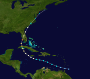
Ike......here we go again

Too soon to know, but yeah, we're dancing around like 2004. Hate to get jaded but you can see where it can happen. Tampa is due - we've been more than fortunate.
 
yesterday it was pointed at us. as i've said, better to be aimed at early than late. regardless, the news has been off the wall. panic, andrew jr, panic, andrew the sequel, panic, panic, panic; aren't you glad we're here to keep you calm, says the newscaster.

i'm afraid to leave the house, not because of any real threat but because of the lines at the gas station, the supermarket, dare i say the words: home depot.

my original plan was to head down to the keys or naples but now that the forecasts are encircling florida there's really no where to run, no place to hide. latest forecast tracked it further south, now coming up the west coast, instead. likely we'll get at least t.s. if not hurricane winds here. good luck to whomever ike hits directly.
 
Lazy and Rich, take care and stay safe! We'll be hoping for the best for both of you and for others in or near Ike's path.

Sarah, I have been thinking about you every time I hear about Hanna, and hoping that this storm leaves you alone!! I heard on the radio that you got a LOT of rain so I hope you are not in a flood prone neighborhood.

I could not find any more details about Hanna or post until now, because of internet access. Yesterday we drove for over 12 hours to get back home to New Orleans. When I finally arrived at my house, I found that I had power after all, which I did not expect!! Wahoo. :D With luck like that, I hardly have reason to complain but will just mention in passing that I have no cable so no internet access or TV. It's just me and that radio, y'know. :) Frank has cable, so I am briefly borrowing his to check the storms and post.

When I came back, I found that a huge branch spanning my entire back yard had been blown off my tree, knocking down and destroying my 6' wooden fence; my shutters were torn off; and a small diameter gas line going to the gas lantern at my front doorway had apparently been hit by flying debris, since it was off and we smelled gas around the corner near the valve (so Frank shut it off, and this appears to have fixed the problem). But, the rest of my community appears to be almost unchanged. Lights and signs for businesses were on and working, as were most stop lights and street lights, and downed power lines have been cleaned up. Our sewer system is now back to normal, so we can shower, flush, and wash clothes. We even had dinner out at a restaurant. What a different experience from Katrina, and what a relief.

Today, the NHC 5-day trajectory for Ike has us as the target once again. http://www.nhc.noaa.gov/refresh/graphics_at4+shtml/144613.shtml?5day?large#contents
Hopefully this will come to nothing as well. I think many people here are tired of evacuating, broke from the last evacuation, and disgusted with the idea of evacuating yet again, and that is a dangerous state of affairs for us.

As for me, I unloaded my car but left everything by the door in case we have to leave again for Ike.
 
Last edited:
Thanks, Lazy. Neither of those are too reassuring! :2funny:

But, you know how it is. A trajectory five days out could very well shift. So, I am attempting to be prepared but nonchalant. Now, if only my stomach would settle down. ^-^
 
<sigh> Still time for it to change its course, for better or worse. Folks on the Gulf Coast remember Charlie, creeping up the coast to Tampa Bay; lots of people evacuated to Orlando. Charlie made a sudden eastward turn, took out Port Charlotte, and slammed Orlando the next day.

W2R - wise to keep yourself psychologically and logistically ready for another unscheduled vacation, but lets hope it shuts down drastically over Cuba.
 
<sigh> Still time for it to change its course, for better or worse. Folks on the Gulf Coast remember Charlie, creeping up the coast to Tampa Bay; lots of people evacuated to Orlando. Charlie made a sudden eastward turn, took out Port Charlotte, and slammed Orlando the next day.
Exactly. Hurricane trajectory prediction is not an exact science, and intensity prediction is worse. But hopefully, after Charlie we will focus on the NHC cone rather than the line at its center, and realize that even the cone can shift. Gustav did not really hit New Orleans but came ashore to the southwest. That is why Baton Rouge (the most usual evacuation destination for New Orleanians) was hit so much harder than New Orleans this time. My suburb seems nearly unaffected by Gustav.

Well, except for my back yard. :rolleyes:

W2R - wise to keep yourself psychologically and logistically ready for another unscheduled vacation, but lets hope it shuts down drastically over Cuba.

Amen to that!! I'd be really happy if this one would just dissipate.
 
Last edited:
I've been admiring Ike for quite some time - very tightly organized.

The 'loop' satellite views on this page are handy: Latest Satellite Imagery

It would be nice if Ike forgets to turn north at Cuba and just heads straight for Mexico. :D
 
talking tvweatherhead earlier today speculated another high could develop just before it hits norleans to send it west to texas instead. this is like playing hot potato with a hurricane. meanwhile, they sent their helicopter to photograph the lines at miami area gas stations. some stations already out of gas & it ain't even coming here. idiots. (a cousin of mine tells me she braved the supermarket last night for fresh fruit, never again. says it was a madhouse.)
 
Well, it's now Texas' turn to get nervous. In the last 24 hours the forecasts have converged on a likely landfall on the central Texas coast.

The storm is expected to take a big hook to the right sometime around the time of landfall on Friday night.

Looks like it's going to be rainy weekend here in Houston, regardless of exactly where it hits. (sigh)

The TV news is beginning to lead with Ike stories. The first voluntary evacuation in this area (near Freeport) was announced this morning.

No high school football games have cancelled yet, though. :)
 
i could do a maneuver like that in my little convertible but that looks like an awfully sharp turn for such a big system to make on saturday. their 3-day projections are often close to target but i don't recall ever seeing an almost 90 degree turn at landfall. i wouldn't be surprised to see that solid black line moving clockwise over the next day or two, closing in on the northern edge of the current cone of death.

 
not even. that punta gorda hit was just a wobble. the general track was a bit of a boomerang but actually a pretty smooth


then again maybe the same just turned some.

looking for histories of 5 & 3-day tracking cones. don't find yet.

looks like they tend to turn like this around texas...


at200809_climo.gif


ok, not finding what i'm looking for but lots of other cool stuff. check this out

ig19_hurricanes_05_02.jpg


from livescience.com " the eye of Hurricane Ivan at center, partially framed by solar array panels on the International Space Station."
 
Take care, y'all. Let's hope Ike veers towards some relatively unpopulated area, or (even better) dissipates.

I still have my evacuation items and lawn furniture piled up in my living room, but if nothing changes then probably tomorrow or the next day I will start putting things away and breathe a huge sigh of relief. Nothing else on the horizon, though as our weather forecaster pointed out it is still the middle of hurricane season.
 
Some of the bands from Ike passed by us this morning and I could not believe they strength of the storm surge with it being so far away . THe water came over our seawall and covered all the neighborhood docks.
 
Hmmm... the latest forecast shows ol' Htown has a 60% or better chance of 39 mph winds by the weekend. 20% chance of hurricane-force winds.

Friday may be a day off from w**k!

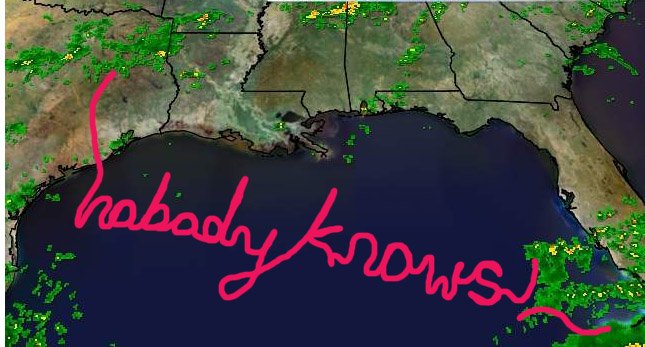
On the other hand, I also did receive this forecast from a friend:
 

Attachments

  • image001.jpg
    image001.jpg
    108 KB · Views: 2
i tried saving a series of projected cones throughout the day to see the change of movement but somehow when i go to copy/paste them, all the links only update to the latest projection.

regardless, as of this morning, the center of the cone of death was aiming for the coast south between corpus christi & port lavaca and now it has moved north, getting uncomfortably close to galveston/houston and that sharp turn shown earlier has smoothed out some.

i might just become a weatherman. i love this stuff (when it isn't pointed at me).
 
Back
Top Bottom