RonBoyd
Give me a museum and I'll fill it. (Picasso) Give me a forum ...
We were behaving in a “lossy” way in the first place!
Great line. I may steal that someday.
We were behaving in a “lossy” way in the first place!
Great line. I may steal that someday.
")
IIRC that's true. We used compressed tiff for business documents and some regulatory bodies were involved in the process.Before you start using 300/600 LOSSLESS, read up a bit. I remember seeing an article that gave excellent examples where a scan at higher resolution, and then compressed, was far better than lower resolution lossless.
Try googling that, and you could experiment. I think you'll find that only a modest amount of compression to a high resolution scan will be needed to produce a file size the same /smaller than the lossless 300/600 scan, and the quality may be far better.
But double check all that. But actually, it seems like common sense. If it were not true, why would we bother with these fancy, complex compression algorithms? We would just cut the resolution down!
-ERD50
IIRC that's true. We used compressed tiff for business documents and some regulatory bodies were involved in the process.
Of course, the other option (the wise one perhaps) is scan with the greatest storage space savings in mind and, if a "treasure" is found, go back and scan it at high resolution.
Is compressed TIF an option in the software?
Never knew what “EXIF” was either!
Yes, EXIF is good to know about. It is what makes Lightroom such a wonderful program. I can, for instance, instantly find the 3 images of "Joe Smith" among my 120,000 images... or of Mt. Rushmore. I can, also, see on a Google map where each of the pictures were taken (well, those taken with my current cameras anyway). So very handy.
FWIW, this is true of the metadata found in other digital files -- i.e., music and video files.
Apollo 8 had entered lunar orbit and they photographed Earthrise over the moon.Fifty years ago today—50 years ago this morning, at a few minutes after 10:30 Central U.S. time—a former USAF fighter pilot named William A. (Bill) Anders, who is now 85 years old and lives in Anacortes, in the State of Washington on the West coast, took one of the indisputably great photographs of the 20th century.
Rather than watching the stock market hurl for yet another day, I’ve been looking into learning more about digital images and in particular metadata.
Then you will want to get the amazing ExifTool by Phil Harvey.
Image metadata is a morass of somewhat related standards and conventions. I finally gave up on managing any more than the basic exposure tags in anything other than my raw files straight out of the camera. When I make a jpeg for posting or such, it just contains date taken, make/model, shutter speed, f-stop, ISO, focal length, and copyright.
In Lightroom, you can drop a pin on a map for your location and I believe it will save the GPS for that location.
You can do the same in the old Apple Aperture program if you have a Mac.
Would you organize photos by location and then script the writing of GPS data to the EXIF?
I didn’t even know there were EXIF fields in scanned images?
How many images are we talking about?
I guess it depends on what kind of precision you want?
You could assign a couple of dozen photos one set of coordinates for say a location like Times Square.
But those photos could have been taken 20 yards apart or maybe you walked around the perimeter and you’d want the map to show your trail of photos?
That’s what I do for instance if I do a sightseeing cruise and I end up with a trail of pins on the map. It’s a bit of a hassle to make sure the Bluetooth receiver and the GPS receiver are updating correctly between shots.
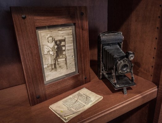
SIL got me this camera. Just need to figure out how to operate it - if it runs. But for now it looks good on the shelf.
I have a small enough set of scanned images to try things out with the help of the previously-mentioned exiftool. If I have any luck I’ll report in the hope that others have similar questions/interests/goals.
exiftool -exif:gpslatitude=LAT -exif:gpslatituderef=LAT -exif:gpslongitude=LON -exif:gpslongituderef=LON FILEMy folks had one just like that, except it was called a Brownie Autiographic., It used A120 film, which I am sure you cannot get anymore. There was a trapdoor on the back of the camera where you could annotate each picture.SIL got me this camera. Just need to figure out how to operate it - if it runs. But for now it looks good on the shelf.
This turned out to be not too hard, thanks to the excellent exiftool. There are so many options, it can be difficult to construct the command you want (that shows how powerful exiftool is).
Here's the template, given coordinates LAT and LON that you want embedded in the image file FILE:
Code:exiftool -exif:gpslatitude=LAT -exif:gpslatituderef=LAT -exif:gpslongitude=LON -exif:gpslongituderef=LON FILE
I tested this on a couple of images, one of Wrigley Field and the other in Paris. Using Wrigley's street address "1060 W. Addison, Chicago IL", gps-coordinates.net returned the coordinates that could be plugged into the above command.
Examining the resulting file with exiftool showed that the information was in the file, but initially I couldn't seem to get digiKam to recognize the new data and flag the image as geotagged. Then I found a menu item "reread metadata from image file". After that, all seemed to work properly and I could select the photo, switch to map view and visit the Friendly Confines.