Radius maps for travel plans?

ohyes

Full time employment: Posting here.
Joined
Sep 24, 2010
Messages
805
You guys will know the answer

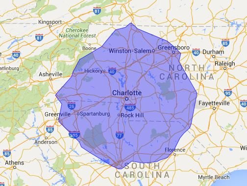
DH and I recently enjoyed a wonderful weekend getaway in Vicksburg, MS....just a four hr drive. This got me wondering about other fun, 2-3 day getaways within short driving distance.

I have been looking for a "radius map". Googling turned up a few, but those do not show town/city names.

Anybody have any suggestions for such an online map? Where one puts in the name of their town/zipcode and # of miles, and a map pops up showing towns/cities within that radius?

If that sounds incredibly lazy on my part....well....:cool:

Thanks.
 
I was thinking of doing that with a paper map and a pencil/string. Two circles, and pick-off the towns between the big circle and the smaller one.
 
lol

I did mention lazy, right?

The atlas showed up the other day.

I guess I could......if the string shows up.

Thanks.
 
It's up to the OP, but I kind of thought what was asked for was a travel time radius. This wouldn't be a circle at all, but a bulging figure that stretches further along limited access highways, and closer for destinations reached via roads with lights, and even closer via backroads.
 
It's up to the OP, but I kind of thought what was asked for was a travel time radius. This wouldn't be a circle at all, but a bulging figure that stretches further along limited access highways, and closer for destinations reached via roads with lights, and even closer via backroads.
Because if you go very far there is a possiblity of multiple routes with different travel times this quickly becomes an unbounded problem. Even if you restrict yourself to more or less direct routes (say no longer than 10 to 15% of the actual distance between points the problem is huge, for example if following an interstate do you take the business loops etc, or if a 2 lane road parallels the interstate a few miles away which do you use. Raw distance is easy, driving distance is a bit harder, as there are areas where the road network is not dense, and time is even less determined. better ro say I want to travel x miles in a day, and then do a chosen route.
 
Because if you go very far there is a possiblity of multiple routes with different travel times this quickly becomes an unbounded problem. Even if you restrict yourself to more or less direct routes (say no longer than 10 to 15% of the actual distance between points the problem is huge, for example if following an interstate do you take the business loops etc, or if a 2 lane road parallels the interstate a few miles away which do you use. Raw distance is easy, driving distance is a bit harder, as there are areas where the road network is not dense, and time is even less determined. better ro say I want to travel x miles in a day, and then do a chosen route.

Well, that radius map doesn't tell you that you can travel x miles to get anywhere in that circle unless you fly like a crow.

Google and other maps manage to figure out travel time to destinations using the best route, so I'd think it's possible, though not at all easy, to be able to draw such a map of where you can get to in, say, 3 hours. The drawback would seem to be the computational time, to essentially calculate 3 hours by freeway or the fastest available roads, then figure out how far you can go from all the side roads off the freeway taking exits before that 3 hour mark.

Easy is drawing a simple circle of x miles around a spot, but it's almost useless. For example, I can see a picnic day campground from my back deck, about a mile or so away, but it takes 20 minutes to drive there.

Harder is distances by roads, but only somewhat useful since it would treat windy backroads same as freeways.

Hardest is time by roads (and ideally other transportation) so you can see just how far you can get if you're willing to drive x hours.

Personally I'm not looking for this tool, but just to say, "Yep, here's a circle, request satisfied, done." doesn't sound right to me.
 
It's up to the OP, but I kind of thought what was asked for was a travel time radius. This wouldn't be a circle at all, but a bulging figure that stretches further along limited access highways, and closer for destinations reached via roads with lights, and even closer via backroads.

I think the old Streets & Trips software used to do this. As I recall it was a pretty neat feature for looking for places to go within xx miles if you weren't familiar with an area.

Sent from my Nexus 7 using Early Retirement Forum mobile app
 
Thanks, folks!

You gave me more to think about when I really just wanted a radius map.

All of your input has been helpful. Appreciate it.

Cheers to our next trip, nearby or faraway. :D
 
Well, that radius map doesn't tell you that you can travel x miles to get anywhere in that circle unless you fly like a crow.

Not to be too fussy about it, but it seems that crows do not generally fly in straight line. Do crows fly in a straight line? - 4Information.com

Apparently the phrase has a nautical origin, using the view from the crow's nest (lookout post) at the top of the main mast of a sailing ship.

Another advantage of being retired is having the time to research petty BS like that.:D
 
Easy is drawing a simple circle of x miles around a spot, but it's almost useless. For example, I can see a picnic day campground from my back deck, about a mile or so away, but it takes 20 minutes to drive there.
After some research (and macro writing), I've determined that the circle is very useful in estimating drive times, that is, given the parameters of my analysis.

I used that 'draw a circle on a map' web site to draw two circles, 75 miles and 100 miles, centered on my hometown. Then I (painstakingly) typed in 207 town names that showed at a particular zoom level. This picked-up very small towns (the sample was not weighted toward big towns, presumably with better access). Then I ran a macro on google maps and scraped the trip duration from my home town to each location.

65% of the destinations were in the expected duration (mapping to the 75 to 100 mile circle). This is based on the average for all destinations, +/- 14.3%.

If one expands the duration to include plus and minus 10% of the duration (in this case, 12 minutes), then there are only 5% of the destinations that are outside of that span.

The 3% of the destinations did exceed this additional 10% band. All of those are towns in the Blue Ridge mountains, so that explains the results from this sample.

Conclusion: Draw your circles and squash it/them slightly if you hit mountains. You'll be VERY close to uniform drive times.
 
Last edited:
Not to be too fussy about it, but it seems that crows do not generally fly in straight line. Do crows fly in a straight line? - 4Information.com

Apparently the phrase has a nautical origin, using the view from the crow's nest (lookout post) at the top of the main mast of a sailing ship.

Another advantage of being retired is having the time to research petty BS like that.:D

Nor do bees. How do they come up with the term "beeline"? On the other hand, when I run out to the backyard to chase away the pest birds that keep eating my seedlings, they fly quite straight, away from me.
 
Not to be too fussy about it, but it seems that crows do not generally fly in straight line. Do crows fly in a straight line? - 4Information.com

Apparently the phrase has a nautical origin, using the view from the crow's nest (lookout post) at the top of the main mast of a sailing ship.

Another advantage of being retired is having the time to research petty BS like that.:D
Hmmmm - my personal observation is that over a distance those crows are flying pretty straight.
 
^ Sengsational...
Answering the age-old question "so, whaddya do all day?" in classic ER fashion.

:)
I find many a rabbit hole to delve. If haven't solved one of the world's problems before lunch, the stress to solve one before bed is too great :LOL:
 
Exactly. Look, I can tell you where to find every podunk town within a 200 mile radius of your place, at least on this side of the border. But that still doesn't mean you'll want to visit them!
 
I am continuing the quest, nonetheless.

This weekend we are headed to Clarksdale, MS and staying at The Shack Up Inn. Booked it about midnight when DH saw a favorite musician of his will be performing there Saturday night.

We will wing these short jaunts until I get "That Radius Thang" worked out.

TY for all your input, helpful and/or interesting. ; )


Sent from my iPhone using Early Retirement Forum
 
How far can I travel

That original site has another link at the top left called "How far can I travel?"

With this one, you can put in a time and driving speed and the circle will not really be a circle - click search and you can watch it draw a jagged driving radius for you.

How Far Can I Travel?
 
That original site has another link at the top left called "How far can I travel?"

With this one, you can put in a time and driving speed and the circle will not really be a circle - click search and you can watch it draw a jagged driving radius for you.

How Far Can I Travel?
Wow, that's one of the world's problems that someone already solved. I can validate that it's mostly a circle, but a little bit squashed at the mountains.
 

Attachments

  • SquashedAtMountains.JPG
    SquashedAtMountains.JPG
    57.3 KB · Views: 6
Well, that radius map doesn't tell you that you can travel x miles to get anywhere in that circle unless you fly like a crow.

Google and other maps manage to figure out travel time to destinations using the best route, so I'd think it's possible, though not at all easy, to be able to draw such a map of where you can get to in, say, 3 hours. The drawback would seem to be the computational time, to essentially calculate 3 hours by freeway or the fastest available roads, then figure out how far you can go from all the side roads off the freeway taking exits before that 3 hour mark.

Easy is drawing a simple circle of x miles around a spot, but it's almost useless. For example, I can see a picnic day campground from my back deck, about a mile or so away, but it takes 20 minutes to drive there.

Harder is distances by roads, but only somewhat useful since it would treat windy backroads same as freeways.

Hardest is time by roads (and ideally other transportation) so you can see just how far you can get if you're willing to drive x hours.

Personally I'm not looking for this tool, but just to say, "Yep, here's a circle, request satisfied, done." doesn't sound right to me.

Wow! Is life really that complicated? Going to the store to get a 1/2 G of milk. Should I go to store A, B or C? Store A is one mile closer than B. But, the milk section in store A is further from the front door than in store B. Also there is a hot dog vendor at store A that may distract me so I had better go to store B. But, store C has a smoother road to it and the milk there usually has an expiration date further out than the other 2 stores. I'm so confused. Maybe I'm just a simpleton.

So if you plan a three hour ride to the town 150 miles away but there is slight traffic that makes the trip 10 minutes longer you turn around at the three hour mark and return home?
 
If you don't live in the mountains you wouldn't understand, especially if you don't try.

The time and driving speed isn't the "end all" solution either, unless you believe that you can drive a hilly, twisted dirt road at the same speed as an interstate.

Like I said, it doesn't really matter to me. I pick out my destinations based on where I want to go, and then I look up the route time on google maps, and if it's too long, I may not go.

For most people, as a rough guide, it probably works fine. Not sure it's much better than just eye-balling a map.
 
Back
Top Bottom