You are using an out of date browser. It may not display this or other websites correctly.
You should upgrade or use an alternative browser.
You should upgrade or use an alternative browser.
This weather is awful!! 2008-2021
- Thread starter Brat
- Start date
- Status
- Not open for further replies.
vicente solano
Thinks s/he gets paid by the post
- Joined
- May 21, 2009
- Messages
- 1,116
freebird5825
Give me a museum and I'll fill it. (Picasso) Give me a forum ...
Hooray for a true west wind. This mess is about 60 miles north of where I live.
NWS radar image loop of Composite Reflectivity from Montague, NY
Having snowplowing service makes it all that much more bearable.
NWS radar image loop of Composite Reflectivity from Montague, NY
Having snowplowing service makes it all that much more bearable.
Ronstar
Moderator Emeritus
Had to scrap frost off the INSIDE of the windshield this morning
Just when I was going to report how our weather sucks, I read this. Having to scrape the inside of a windshield is impressive!
Well--
(whine, snivel, whimper...)
We're into our third day of record-breaking weather:
StarAdvertiser.com - Mobile Edition
The solar water heater is hovering around 90 degrees instead of its usual 150+. If we don't get an hour or two of sunshine today (or at least "less overcast") then I might actually have to turn on its backup electric element.
The good news is we've confirmed that all our roof-leak repairs over the last few years have solved the problem both here and at our rental.
I'm still waiting for an update on the Mauna Kea Snowboarding Championship...
http://archives.starbulletin.com/2006/01/31/news/story02.html
(whine, snivel, whimper...)
We're into our third day of record-breaking weather:
StarAdvertiser.com - Mobile Edition
It's been impressive, but it turns out that the term "storm drain" is oxymoronic.Honolulu officials warned drivers to stay put yesterday as gauges across the southeastern half of Oahu showed rain falling at 1.5 inches to 3 inches per hour — with even more rain continuing to bear down on Oahu from the south.
Over the 24-hour period ending at 5 p.m. yesterday, Honolulu Airport received 5.3 inches of rain, breaking the previous rainfall record of 5.28 inches set in 1955.
The solar water heater is hovering around 90 degrees instead of its usual 150+. If we don't get an hour or two of sunshine today (or at least "less overcast") then I might actually have to turn on its backup electric element.
The good news is we've confirmed that all our roof-leak repairs over the last few years have solved the problem both here and at our rental.
I'm still waiting for an update on the Mauna Kea Snowboarding Championship...
http://archives.starbulletin.com/2006/01/31/news/story02.html
Last edited:
freebird5825
Give me a museum and I'll fill it. (Picasso) Give me a forum ...
Can you say Nor'easter? I knew you could.
Excerpt courtesy of NOAA - National Oceanic and Atmospheric Administration, the text of the Blizzard Warning issued by the NWS.
...BLIZZARD WARNING IN EFFECT FROM NOON SUNDAY TO 6 PM EST
MONDAY...THE NATIONAL WEATHER SERVICE IN TAUNTON HAS ISSUED A BLIZZARD WARNING...WHICH IS IN EFFECT FROM NOON SUNDAY TO 6 PM EST MONDAY.
THE WINTER STORM WATCH IS NO LONGER IN EFFECT.
* LOCATIONS...ALL OF RHODE ISLAND EXCEPT BLOCK ISLAND AND ALL OF
EASTERN MASSACHUSETTS EXCEPT CAPE COD AND THE ISLANDS.
* HAZARD TYPES...HEAVY SNOW AND POTENTIALLY DAMAGING WINDS...WITH CONSIDERABLE BLOWING AND DRIFTING OF SNOW AND NEAR ZERO VISIBILITIES. SCATTERED THUNDERSTORMS WITH SNOW.
* ACCUMULATIONS...15 TO 20 INCHES OF SNOW.
* TIMING...LIGHT SNOW WILL START IN THE EARLY AFTERNOON AND BECOME HEAVY BY EVENING. VERY HEAVY SNOW WILL FALL THROUGHOUT SUNDAY NIGHT WITH UP TO 2 TO 4 INCHES PER HOUR LIKELY AT TIMES. THE
SNOW WILL TAPER TO FLURRIES EARLY MONDAY AFTERNOON. WINDS WILL
PEAK FROM LATE SUNDAY AFTERNOON THROUGH MUCH OF MONDAY.
* WINDS...NORTHEAST TO NORTH WINDS WILL INCREASE TO 25 TO 35 MPH
WITH GUSTS AS HIGH 50 TO 60 MPH ESPECIALLY ALONG COASTAL RHODE
ISLAND AND COASTAL MASSACHUSETTS FROM LATE SUNDAY AFTERNOON
THROUGH MUCH OF MONDAY.
* TEMPERATURES...WILL RANGE FROM THE MID 20S TO LOWER 30S.
* VISIBILITIES...ONE QUARTER MILE OR LESS AT TIMES.
I probably shouldn't say anything but it's been quite nice here, high today of 11. Not much snow, at least compared to last year when we got 12 inches on Christmas Eve. Temperatures not bad either; the coldest predicted for the next 10 days is about -1. This time of year -30 would not be unusual.
Neighbor's son came down from Philly to visit for Christmas. He was supposed to fly back Monday. I called her earlier this evening and suggested he might want to change his flight to Tuesday ASAP because getting home on Monday wasn't looking good. Haven't heard the result.
theloneranger
Recycles dryer sheets
- Joined
- Dec 27, 2006
- Messages
- 154
37 degrees F here now.
28 tonight; no show.
41 degress tomorrow.
Golf in the high 50's on Wednesday.
Love the South.
28 tonight; no show.
41 degress tomorrow.
Golf in the high 50's on Wednesday.
Love the South.
freebird5825
Give me a museum and I'll fill it. (Picasso) Give me a forum ...
If anyone is still not convinced to NOT travel, show (or email) them this:Neighbor's son came down from Philly to visit for Christmas. He was supposed to fly back Monday. I called her earlier this evening and suggested he might want to change his flight to Tuesday ASAP because getting home on Monday wasn't looking good. Haven't heard the result.
NWS - Enhanced Doppler Radar National Mosaic Loop
The entire Eastern seaboard is being affected by this monster storm. This is not trivial weather.
grasshopper
Thinks s/he gets paid by the post
- Joined
- Oct 9, 2010
- Messages
- 2,475
New Year going out with a freeze! We have the annual Christmas [-]beer[/-] Bird Count on New Years Day this year.
I guess I won't be wearing shorts
Forecast for Eastern Cochise County below 5000 feet
Area Forecast For:
Issued: December 26, 2010 03:05:05 MST
Today: Partly cloudy. Highs 61 to 66.
Monday: Partly cloudy. Highs 57 to 62.
Tuesday: Partly cloudy. Highs 58 to 63.
Wednesday: Breezy. Mostly cloudy. Highs 55 to 60.
Thursday: Windy. Mostly cloudy with a 40 percent chance of showers. Highs 46 to 60.
Friday: Mostly cloudy with a 30 percent chance of rain and snow showers. Highs 42 to 47.
New years day: Partly cloudy. . Highs 40 to 47.
Tonight and tomorrow night we are supposed to have a hard freeze here in central Florida. It's been cold here since Dec. 1st. Last year it was cold from Jan 1st into March. The first 2 years we were here we didn't have to turn on the heat. The last 2 winters we haven't shut if off. Thinking of moving south and get away from the Tundra.
I can say Nor'easter!
My brother's driving home from New Hampshire to Rhode Island today, right into the blizzard. But they left early, I think they are just going to hit some snow before they get home. In Kansas City it's just cold but now the sun is out.
My brother's driving home from New Hampshire to Rhode Island today, right into the blizzard. But they left early, I think they are just going to hit some snow before they get home. In Kansas City it's just cold but now the sun is out.
RonBoyd
Give me a museum and I'll fill it. (Picasso) Give me a forum ...
... here in central Florida. ... Thinking of moving south and get away from the Tundra.
"Twelve Days of Christmas,” North Dakota style:
12 degrees below zero
11 knoephlas drowning
10 Snirts-a-Snirting
9 broken shovels
8 leftover lutefisk
7 kinds of kuchen
6-pack of beer
5 drunk Norwegian uncles
4 chilly cheeks
3 feet of snow
2 frozen nostrils
and a tourist who lost his way.
12 degrees below zero
11 knoephlas drowning
10 Snirts-a-Snirting
9 broken shovels
8 leftover lutefisk
7 kinds of kuchen
6-pack of beer
5 drunk Norwegian uncles
4 chilly cheeks
3 feet of snow
2 frozen nostrils
and a tourist who lost his way.
freebird5825
Give me a museum and I'll fill it. (Picasso) Give me a forum ...
"Twelve Days of Christmas,” North Dakota style:
12 degrees below zero
11 knoephlas drowning
10 Snirts-a-Snirting
9 broken shovels
8 leftover lutefisk
7 kinds of kuchen
6-pack of beer
5 drunk Norwegian uncles
4 chilly cheeks
3 feet of snow
2 frozen nostrils
and a tourist who lost his way.
Take 10 points!
aaronc879
Give me a museum and I'll fill it. (Picasso) Give me a forum ...
- Joined
- Jan 10, 2006
- Messages
- 5,355
"Twelve Days of Christmas,” North Dakota style:
12 degrees below zero
11 knoephlas drowning
10 Snirts-a-Snirting
9 broken shovels
8 leftover lutefisk
7 kinds of kuchen
6-pack of beer
5 drunk Norwegian uncles
4 chilly cheeks
3 feet of snow
2 frozen nostrils
and a tourist who lost his way.
That's like a joke we have up here in Wisconsin. "What do you call a tourist in Wisconsin in January?" LOST!
freebird5825
Give me a museum and I'll fill it. (Picasso) Give me a forum ...
I knew you could. Mister Rogers would be so proud.I can say Nor'easter!
My brother's driving home from New Hampshire to Rhode Island today, right into the blizzard. But they left early, I think they are just going to hit some snow before they get home. In Kansas City it's just cold but now the sun is out.
We are now in the grips of the mess. Hope he got home OK.

PS I am here in Dracut MA on a holiday visit.
harley
Give me a museum and I'll fill it. (Picasso) Give me a forum ...
I always used to tell DW "it never snows at the beach". Part of my argument for moving there. So we're in Leesburg (DC area) for the holidays, and we got a dusting. But back home they're looking at 10 - 15 inches. Driving home into it tomorrow. If possible. I won't hear the end of this anytime soon.
nphx
Recycles dryer sheets
- Joined
- May 31, 2007
- Messages
- 345
<begin gloat>The pilot reported we were the last flight to depart JFK last night<end gloat>... it will be mid 60's today
RonBoyd
Give me a museum and I'll fill it. (Picasso) Give me a forum ...
kumquat
Thinks s/he gets paid by the post
Sounds like "warm temperatures but otherwise normal winter driving conditions".Can you say Nor'easter? I knew you could.
Excerpt courtesy of NOAA - National Oceanic and Atmospheric Administration, the text of the Blizzard Warning issued by the NWS.
...BLIZZARD WARNING IN EFFECT FROM NOON SUNDAY TO 6 PM EST
MONDAY...THE NATIONAL WEATHER SERVICE IN TAUNTON HAS ISSUED A BLIZZARD WARNING...WHICH IS IN EFFECT FROM NOON SUNDAY TO 6 PM EST MONDAY.
THE WINTER STORM WATCH IS NO LONGER IN EFFECT.
* LOCATIONS...ALL OF RHODE ISLAND EXCEPT BLOCK ISLAND AND ALL OF
EASTERN MASSACHUSETTS EXCEPT CAPE COD AND THE ISLANDS.
* HAZARD TYPES...HEAVY SNOW AND POTENTIALLY DAMAGING WINDS...WITH CONSIDERABLE BLOWING AND DRIFTING OF SNOW AND NEAR ZERO VISIBILITIES. SCATTERED THUNDERSTORMS WITH SNOW.
* ACCUMULATIONS...15 TO 20 INCHES OF SNOW.
* TIMING...LIGHT SNOW WILL START IN THE EARLY AFTERNOON AND BECOME HEAVY BY EVENING. VERY HEAVY SNOW WILL FALL THROUGHOUT SUNDAY NIGHT WITH UP TO 2 TO 4 INCHES PER HOUR LIKELY AT TIMES. THE
SNOW WILL TAPER TO FLURRIES EARLY MONDAY AFTERNOON. WINDS WILL
PEAK FROM LATE SUNDAY AFTERNOON THROUGH MUCH OF MONDAY.
* WINDS...NORTHEAST TO NORTH WINDS WILL INCREASE TO 25 TO 35 MPH
WITH GUSTS AS HIGH 50 TO 60 MPH ESPECIALLY ALONG COASTAL RHODE
ISLAND AND COASTAL MASSACHUSETTS FROM LATE SUNDAY AFTERNOON
THROUGH MUCH OF MONDAY.
* TEMPERATURES...WILL RANGE FROM THE MID 20S TO LOWER 30S.
* VISIBILITIES...ONE QUARTER MILE OR LESS AT TIMES.
Looks like a New Year's Eve at home this year.
This Afternoon: Widespread blowing snow and a slight chance of snow. Partly sunny, with a steady temperature around -4. Wind chill values as low as -31. Blustery, with a north wind between 23 and 25 mph, with gusts as high as 36 mph. Chance of precipitation is 20%.
Tonight: Widespread blowing snow and a slight chance of snow. Mostly cloudy, with a low around -6. Wind chill values as low as -31. Blustery, with a north wind between 23 and 26 mph, with gusts as high as 37 mph. Chance of precipitation is 20%.
Friday: Widespread blowing snow and a chance of snow. Partly sunny, with a high near 1. Wind chill values as low as -31. Blustery, with a north wind between 21 and 24 mph, with gusts as high as 33 mph. Chance of precipitation is 30%. New snow accumulation of less than a half inch possible.
Friday Night: Snow likely and widespread blowing snow. Cloudy, with a low around -1. Wind chill values as low as -26. Blustery, with a north wind between 25 and 29 mph, with gusts as high as 41 mph. Chance of precipitation is 70%.
New Year's Day: Widespread blowing snow and a chance of snow. Cloudy, with a high near 4. Windy, with a north northwest wind 27 to 30 mph decreasing to between 17 and 20 mph. Winds could gust as high as 41 mph. Chance of precipitation is 40%.
Westernskies
Thinks s/he gets paid by the post
- Joined
- May 5, 2008
- Messages
- 3,864
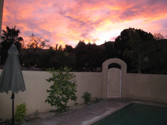
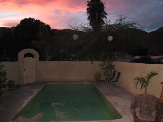
Big Storm blowing into PHX.
Forecast is for Hard Freeze warnings for outlying areas., with Snow down to 2000' Elevation. (Hopefully I'll be able to post some desert snow pictures.)
Need to get out to cover the Bougainvillea and Lantana...
Forecast is for Hard Freeze warnings for outlying areas., with Snow down to 2000' Elevation. (Hopefully I'll be able to post some desert snow pictures.)
Need to get out to cover the Bougainvillea and Lantana...
- Status
- Not open for further replies.
Similar threads
- Replies
- 12
- Views
- 542