Next hurricane headed toward LA/MISS?

I am curious why everyone on this thread seems to refer to the Greek-letter-named storms in ALL CAPS. We didn't talk about hurricanes ISAIAS, or LAURA, or SALLY. Why does everyone seem to refer to ETA and THETA instead of Eta and Theta?

Maybe it is the same as people who write ROTH vs. Roth? :D

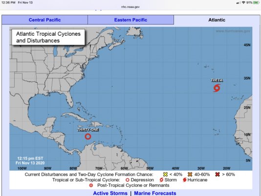
I’m not sure why, but I have noticed the National Hurricane Center uses all caps for storm names on their main graphic.
 

Attachments

  • 56A6660D-7CEC-4A16-AD11-624B0FD9AB6A.jpg
    56A6660D-7CEC-4A16-AD11-624B0FD9AB6A.jpg
    344.7 KB · Views: 11
Last edited:
Iota as a name will be fun!

I am learning the Greek alphabet - although I do remember the symbols from engineering school.
 
Look at the map I posted above from the NWS...Maybe that's why?

But that is just WX-speak. They (traditionally) do all read-outs, warnings, etc. in ALL CAPS.

They also would have written LAURA, JOSEPHINE, etc., on the comparable maps. Earlier today, their map read THIRTY-ONE.
 
But that is just WX-speak. They (traditionally) do all read-outs, warnings, etc. in ALL CAPS.

They also would have written LAURA, JOSEPHINE, etc., on the comparable maps. Earlier today, their map read THIRTY-ONE.
I just copied the named from the graphic... Let us know if you figure it out. No need to rush. But to steal a partial quote from an earlier post, I don't give one Iota. :D
 
Last edited:
I'm not looking forward to when they run out of Greek letters and have to start using the Klingon alphabet.
 
^^^^ :LOL::LOL::LOL:


Dang, I should have thought of that one!
 
Last edited:
Iota (everyone happy now) is now a named storm
 
^^^^Thought it was pretty funny in my post 313 too....


Now back to the storm which looks like it could make it to a strong Cat 3, at this point... Moving up fast.....


INIT 13/2100Z 13.8N 74.3W 35 KT 40 MPH
12H 14/0600Z 13.7N 75.1W 45 KT 50 MPH
24H 14/1800Z 13.7N 76.2W 55 KT 65 MPH
36H 15/0600Z 13.9N 77.5W 70 KT 80 MPH
48H 15/1800Z 14.2N 79.3W 85 KT 100 MPH
60H 16/0600Z 14.6N 81.2W 95 KT 110 MPH
72H 16/1800Z 15.0N 82.8W 105 KT 120 MPH
 
Last edited:
There’s not one iota of difference. Isn’t that the phrase?

It looks like Iota is starting out at about the same track as crazy Eta but then will head southwest.
 
Last edited:
I am curious why everyone on this thread seems to refer to the Greek-letter-named storms in ALL CAPS. We didn't talk about hurricanes ISAIAS, or LAURA, or SALLY. Why does everyone seem to refer to ETA and THETA instead of Eta and Theta?

Maybe it is the same as people who write ROTH vs. Roth? :D

Just checking to see if you were paying attention.:facepalm:
 
The latest advisory on Iota is looking very good for the US, but not good at all for Central America. Looks like a strong Cat 4 is now predicted at landfall. Models I've been watching also seem to be in much better agreement.

INIT 15/1500Z 13.3N 78.5W 80 KT 90 MPH
12H 16/0000Z 13.8N 79.7W 95 KT 110 MPH
24H 16/1200Z 14.2N 81.4W 110 KT 125 MPH
36H 17/0000Z 14.4N 82.9W 120 KT 140 MPH
48H 17/1200Z 14.5N 84.3W 80 KT 90 MPH...INLAND
60H 18/0000Z 14.4N 85.5W 45 KT 50 MPH...INLAND
72H 18/1200Z 14.3N 86.8W 30 KT 35 MPH...INLAND
96H 19/1200Z 13.8N 89.8W 20 KT 25 MPH...
POST-TROP/REMNT LOW 120H 20/1200Z...DISSIPATED
 
Last edited:
We have close friends in Panama who suffered significant damage to their farm a few weeks ago. Hurricanes have been absolutely brutal to Central America this year, especially Honduras.
 
We have close friends in Panama who suffered significant damage to their farm a few weeks ago. Hurricanes have been absolutely brutal to Central America this year, especially Honduras.

And Panama "was" supposed a safe haven, it was where we used to take our sailboat in the Summer when we were cruisers.
 
The latest advisory on Iota is looking very good for the US, but not good at all for Central America. Looks like a strong Cat 4 is now predicted at landfall. Models I've been watching also seem to be in much better agreement.

INIT 15/1500Z 13.3N 78.5W 80 KT 90 MPH
12H 16/0000Z 13.8N 79.7W 95 KT 110 MPH
24H 16/1200Z 14.2N 81.4W 110 KT 125 MPH
36H 17/0000Z 14.4N 82.9W 120 KT 140 MPH
48H 17/1200Z 14.5N 84.3W 80 KT 90 MPH...INLAND
60H 18/0000Z 14.4N 85.5W 45 KT 50 MPH...INLAND
72H 18/1200Z 14.3N 86.8W 30 KT 35 MPH...INLAND
96H 19/1200Z 13.8N 89.8W 20 KT 25 MPH...
POST-TROP/REMNT LOW 120H 20/1200Z...DISSIPATED

Not only that, but it’s following Eta’s initial landfall path, and that came in at 145mph!
 
Looks like Iota is less than 24 hours away before it will make landfall in Nicaragua... Almost a Cat 5 (close enough)... Not good at all for them and surrounding countries. Hopefully this is the last one for the season but I'm not taking any bets!
 
Last edited:
And now Iota is a Category 5 hurricane. :(

From the NHC discussion (emphasis mine),

NHC said:
An Air Force Reserve Hurricane Hunter aircraft found maximum 700-mb flight-winds of about 147 kt, with SFMR values of 140-145 kt, and a central pressure of about 917 mb. A blend of all these data leads to an initial wind speed of 140 kt, making Iota a category 5 hurricane, the latest category 5 on record for the Atlantic basin. A little more strengthening is possible today with fairly light shear and warm waters before Iota makes landfall tonight. Rapid weakening is anticipated over central America, and Iota should dissipate in a couple of days.
 
Back
Top Bottom