Utah's "Mighty Five" National Parks in May

My fond memory of the north rim of the GC, was not so much the GC (which is great), but the drive up from it. I left the rim close to sunset time (I know, you are supposed to watch the sunset there, but it was a little overcast, so I said screw it). The road leading up from the rim to Jacob Lake has lots of meadows next to it, and there were thousands of deer in the meadows. So many, I was concerned about them getting close to the road and committing suicide on my car. But, none did, and I was treated to a terrific wildlife show.

Which reminds me of my best ever wildlife encounter, which was in Yellowstone. We were driving along a river and saw a large herd of bison on the other side. We pulled over to watch. The herd then started crossed the river, and heading right towards us. We got back in the car and just sat there. The entire herd walked around our car, both sides, and there must have been well over one hundred bison. We were just inches away from these huge animals, on both sides of the car. It was spectacular. Looking back on this later, we were *really* lucky that one of them did not decide to take a shorter path and walk over the hood, or that one of them did not get spooked by us in the car.

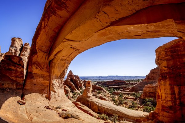
And ditto about Bryce and Arches...I like them better than Zion.

I went to Arches about midnight on a clear night, and got a pretty good view of the Milky Way.
 
Last edited:
We spent 4 days in Yellowstone and at first the bison were awesome but by day 3 we were hoping to see more variety in wildlife. When entering the park a bison was charging our motor home until we came to a complete stop and it lost interest luckily. I had to book a year in advance to be able to stay in the park.
 
We did multiple trips and it worked out great. Mostly on trips to/from our Az condo from Illinois home

We've been to most of the Utah 5 parks 3 times or so. I didn't try to fit everything in 1 trip. Rather we found things on our first trips that we wanted to see and we visited those places on subsequent trips.

I've since discovered some places online that I'd like to see so I expect to go back.

Tough to get it all in in 1 trip.

We have spent now 23 weeks in UT & AZ over 6 trips. Some of the trips were around a month long. There is so much here.

Coyote Buttes South wilderness area
Tower Arch
 

Attachments

  • DSC_0689-90.jpg
    DSC_0689-90.jpg
    682.2 KB · Views: 24
  • DSC_3043.jpg
    DSC_3043.jpg
    701.7 KB · Views: 21
Great pics!

We are looking forward to "only" 20 days. But yes, staggering possibilities.
 
YouTube is an excellent source of info too. Search the area you want to explore and dozens of videos pop up. It’s how we plan our trips. Sometimes you find things less known or seldom talked about.
The popular places, some mentioned in this tread, can be overwhelmed with tourists.

We found a slot canyon on YouTube in Escalante Grand Staircase that has perfect acoustics and my wife hiked in her ukulele. We sat at the back of it, no people, played music.
Picture of it below.
 

Attachments

  • 140BF87C-EF4A-48A7-9BBE-725170322D1C.jpg
    140BF87C-EF4A-48A7-9BBE-725170322D1C.jpg
    594.3 KB · Views: 24
Last edited:
Panguitch, UT is a small town near Bryce Canyon with a rich history, don't miss Quilt Walk Park and memorial. It's an inspiring story of pioneer toughness and survival.

The Annual Panguitch Balloon Rally in June is fun too.

Skip 4 corners monument, cheesy tourist trap.

Yes, a bit cheesy. However, I promised myself that I wanted to get a picture of my cat with one paw in Utah, one paw in Colorado, one paw in New Mexico, and one paw in Arizona, so off to Four Corners we went. There was a sign at the entrance saying "No Dogs" but it didn't say anything about cats :LOL: I'm sure that plenty of humans have taken that type of photo, but my cat is most likely occupying rarefied territory. Strangely, she seems blithely unaware of this.
 
The Annual Panguitch Balloon Rally in June is fun too.


Yes, a bit cheesy. However, I promised myself that I wanted to get a picture of my cat with one paw in Utah, one paw in Colorado, one paw in New Mexico, and one paw in Arizona, so off to Four Corners we went. There was a sign at the entrance saying "No Dogs" but it didn't say anything about cats :LOL: I'm sure that plenty of humans have taken that type of photo, but my cat is most likely occupying rarefied territory. Strangely, she seems blithely unaware of this.

The four corners monument is actually in the wrong spot.
 
The four corners monument is actually in the wrong spot.

Courts have held that the current monument location, albeit not where it was originally intended to be, was established in accordance with information, practices and procedures that were correct for the time when the state lines were originally surveyed and the four corners monument set.


So while the monument is not in the place where it was intended, it's location is not wrong.


The state lines were originally planned to be at specific latitudes and longitudes. From what I understand, the state lines were then surveyed from previously established points of accepted latitude and longitude within the continental United States . Problem was the old starting points were not at latitudes and longitudes that they thought they were.

I know it's difficult for the general public to understand how something in the wrong place can be right, but it is. And this happens all the time. The more accurate that GPS becomes, the more inaccurate the old surveys become. And lines cannot be moved every time new technology comes along.
 
Last edited:
Yes, what Ronstar said. This article explains it in a bit more detail -

https://www.ngs.noaa.gov/INFO/fourcorners.shtml

As for me, I wasn't particularly bothered whether it's in the right or the wrong place, as I was going for the photo op. Not many cats can claim to have been standing in four states at the same time!
 
Last edited:
I was going for the photo op. Not many cats can claim to have been standing in four states at the same time!

Next step: the Four Corners Monument in Canada, where Saskatchewan, Manitoba, Northwest Territories, and Nunavut meet. The only problem is that it's kind of in the middle of nowhere, and there are no roads nearby.
 

Attachments

  • Screenshot 2023-04-18 at 4.42.36 PM.jpg
    Screenshot 2023-04-18 at 4.42.36 PM.jpg
    786.5 KB · Views: 19
^ I need to go after that one. Been to many state corners, and mason Dixon line mileposts, but those are easy compared to that Canadian corner.
 
Geesh I don't know where to begin.

Definitely agree with COcheesehead on getting a Navajo guide in Monument Valley for reasons explained. Spend the night at The View - hotel on site. Unbelievable nighttime views.

Go to an outfitter in Springdale / Zion and get gear to hike the Narrows, unless the river is at flood stage. we didn't do Angel's Landing - crazy crowded.

In Page, take tours of upper and lower Antelope Canyon. And Horseshoe Point.

Hike to Delicate Arch in Arches.

Mesa Arch in Canyonlands.

Hang out in Moab for a day of rest.

Bryce is stunning. I've never seen anything like it.

I agree- Bryce is unbelievable. I literally cried. It was a spiritual experience.
 
I agree- Bryce is unbelievable. I literally cried. It was a spiritual experience.
Yes. I am not religious, and not that spiritual either, but Bryce was very impressive and deeply moving. It was at a point in my trip where, frankly, I was getting a bit burned out on seeing big landscapes and cool things. Then I saw Bryce, which took it to a whole new level.
 
If you are into kayaking or canoeing, try float/paddle from Glen Canyon dam to Lees Ferry. You'll need to hire the backhaul service to carry your kayak from Lee's Ferry to the dam. The canyon walls along the way down are simply awesome..probably reminiscent of going down the Colorado River in Glen Canyon before the lake was created. The water is 40 degrees coming out from the dam. The 16 mile one way trip normally takes us 7-8 hours including stopping at Horseshoe Bend to eat and wave to the people looking down from above.
You can also do a boat trip but that just goes by too fast. There are a few campgrounds if you want to spend more time.
 
Last edited:
Haven’t read every part of the thread but several things-

Remember that Arizona does not do Daylight Saving Time. Navajo territory like Monument Valley does do DST. Plan accordingly.

Agree that Antelope Canyon was beautiful.

Consider buying the JustAhead app for like $30 you get a gps activated guide book that kicks in with relevant ideas and comments for you depending on where you are in a variety of National Parks. Very fun. We did Bryce Canyon on a free trial and liked it so much we bought the whole thing for subsequent National Park visits.
 
It will be helpful to take note of the elevations of your destinations. Zion is at roughly 4,000’ and Bryce at 8,000’ above sea level. So the weather can be substantially different between the two.

I agree on the North Rim being highly desirable, but not likely accessible this year.

Bryce is my favorite park, ever. I live about 1-hour from Zion and we RV camp extensively in the region. Also be aware that Canyonlands has 3 zones, not easy to see more than one zone. The Island in the Sky area is most popular and Dead Horse State Park is a handy side-trip when visiting there.

One route option to consider is South Rim, then work your way to 2-3 UT parks.

If you can stay near Escalante, dinner or lunch at Hells Backbone Grill is absolutely worth it. And the Burr Trail is an amazing 1-day out-and-back drive if you don’t mind the possibility of the dirt road being in washboard condition.

Lots of other good advice here (e.g. Goblin Valley SP).

Final tip - look out for speed limit changes in small towns ($$$).

Enjoy!

Best regards,
Chris
 
If you are into kayaking or canoeing, try float/paddle from Glen Canyon dam to Lees Ferry. You'll need to hire the backhaul service to carry your kayak from Lee's Ferry to the dam. The canyon walls along the way down are simply awesome..probably reminiscent of going down the Colorado River in Glen Canyon before the lake was created. The water is 40 degrees coming out from the dam. The 16 mile one way trip normally takes us 7-8 hours including stopping at Horseshoe Bend to eat and wave to the people looking down from above.
You can also do a boat trip but that just goes by too fast. There are a few campgrounds if you want to spend more time.
That sounds amazing!
 
It will be helpful to take note of the elevations of your destinations. Zion is at roughly 4,000’ and Bryce at 8,000’ above sea level. So the weather can be substantially different between the two.

I agree on the North Rim being highly desirable, but not likely accessible this year.

Bryce is my favorite park, ever. I live about 1-hour from Zion and we RV camp extensively in the region. Also be aware that Canyonlands has 3 zones, not easy to see more than one zone. The Island in the Sky area is most popular and Dead Horse State Park is a handy side-trip when visiting there.

One route option to consider is South Rim, then work your way to 2-3 UT parks.

If you can stay near Escalante, dinner or lunch at Hells Backbone Grill is absolutely worth it. And the Burr Trail is an amazing 1-day out-and-back drive if you don’t mind the possibility of the dirt road being in washboard condition.

Lots of other good advice here (e.g. Goblin Valley SP).

Final tip - look out for speed limit changes in small towns ($$$).

Enjoy!

Best regards,
Chris

Thanks for the great tips. We plan to see whatever we can in North Rim.

Have been to South Rim a few times and did a rim2river2rim hike from that side (snow on ground at top, 95 degrees at river). I do want to do a raft trip through GC but that will be next time.

Thanks for notes on elevation. Yes I am kind of curious the weather variance we will face and what we will pack for our layers.

Need to see about Escalate.

All the best.
 
DH and I did this trip last year right after I retired. You are getting lots of good advice here, so I won't pile on. Just one suggestion I haven't seen yet. We hired a jeep driver in Moab that was FANTASTIC! Dan Mick's Jeep Tours. Dan's son Rick took us into Moab for a couple of hour's drive. I believe Dan is trying to retire. Rick was awesome...has been driving the park since he was a toddler on his dad's lap. Highly recommend doing this!! You can get a glimpse of this in a Kia Sorento ad that Rick was filmed in.

Have fun and enjoy! We loved it.
 
The Annual Panguitch Balloon Rally in June is fun too.


Yes, a bit cheesy. However, I promised myself that I wanted to get a picture of my cat with one paw in Utah, one paw in Colorado, one paw in New Mexico, and one paw in Arizona, so off to Four Corners we went. There was a sign at the entrance saying "No Dogs" but it didn't say anything about cats :LOL: I'm sure that plenty of humans have taken that type of photo, but my cat is most likely occupying rarefied territory. Strangely, she seems blithely unaware of this.

It didn't happen unless you post a pic of your cat :cool:
 
It will be helpful to take note of the elevations of your destinations.


Funny story-
we were at Lake Powell, a sunny day - elevation ~3600 ft. We applied sun lotion and closed the bottle and finished our day.


Then we drove to Bryce. Next day at Bryce, cooler, sure, but still quite sunny. Elevation 7600 ft,


We opened the bottle of suntan lotion to apply and it just kept flowing and flowing and flowing as the bottle (closed at a higher atmospheric pressure) slowly oozed out into the lower atmospheric pressure.
 
Back
Top Bottom