Spot and Spotwalla Trackers

Sarah in SC

Moderator Emeritus
Joined
Sep 19, 2005
Messages
13,566
Location
Charleston, SC
Hey, are there any forum folks using Spot GPS devices and Spotwalla for tracking their travels? I'm trying to learn how to use the data in Google Earth to plot our distances covered on a recent trip and it is more than a little confusing.

Has anyone ever messed with the gpx data or something like it? I'm also trying to figure out how to input some missing waypoints, too.

Thanks!
 
I recently bought the Delorme InReach SE (similar to Spot).

Haven't used it much, but very pleased with its performance so far, both in terms of operation and ability to send/receive text messages to/from anyone.
 
Heard good things about that device and it is definitely friendly with the Spotwalla site. Here's my latest tinkering with the Spotwalla, but I can't quite get the image I want.
 

Attachments

  • Shore to Shore Spotwalla.jpg
    Shore to Shore Spotwalla.jpg
    287.3 KB · Views: 31
You might try over here:
Spot Satellite Tracker - ADVrider

This board is for adventure motorcyclists, many of whom use spots on every trip they take. Many are way into it and fit the "geek" category.

Post #4 mentions what looks like an alternative to Spotwalla.

I use one but only to assure my wife that all is well and I am at the green maptack...
 
Thanks, Bld!

Definitely agree with the first poster on that thread about the lithium batteries. We carried a 1st gen with us, that used AA ones, so I had a big supply of those. But, that one got nicked in UK, so we bought a 2nd gen in Germany, which had the AAA ones. I spent the rest of the trip searching without luck for the Lithium ones, to no avail. We used the best alkaline we could find, but it ate 'em like snack crackers.

I found a way to download the Spotwalla data in csv, so I've set my Excel guru boss to the task of creating my perfect route map using the data. I will definitely roam around there and you reminded me I should look at the HUBB forum as well.

And hey, we just checked in in Seattle--do you see a big yellow bus nearby? :) Probably not, she's still stuck at the port of Tacoma waiting for a bug inspection.
 
Sounds like you are heading on a nice venture, send us some pictures! [Seattle was a lot more fun a couple of weeks ago in the nice fall weather.]

Right..HUBB...now those people are serious!
 
Yeah, they were a HUGE help to us in a sticky situation getting the bus temporarily imported to Japan when we were coming from Vladivostok. Most folks have a Carnet for Japan, but we couldn't get one, so just hoped to wing it. One of their mods was an absolute lifesaver with his help, on short notice, to get us the right forms.

Actually much of the trip is done, as you can see from the track--the bus left for England in June and just arrived in Seattle yesterday. Long way round. ;) But there is still adventuring to do. I think we might go to the Overlander Expo in Flagstaff in May next year. It looks like fun and would fit in with our timetable for closing the loop on the circumnavigation.

Sadly, I'm back home in Chas, but DH is out there imbibing those fine local beers in Seattle as we speak!
 
Good stuff...Is there a blog or something that I am missing?
 
I've been active on both advrider and expeditionportal for several years, lately on the latter. I have a SPOT for emergencies but don't use it for tracking. Would love to read your blog! I love road-trips, especially the off-the-beaten-path variety.
 
bld, I thought you'd appreciate that a guy who works at the Tacoma port sent us a Tweet with a photo of our bus parked at the port. Nice to see her after so many weeks of anxious waiting while she crossed the North Pacific. Now if we could just get them to turn her loose!
 

Attachments

  • Copy of tacoma port.jpg
    Copy of tacoma port.jpg
    103.5 KB · Views: 15
I've been active on both advrider and expeditionportal for several years, lately on the latter. I have a SPOT for emergencies but don't use it for tracking. Would love to read your blog! I love road-trips, especially the off-the-beaten-path variety.

Any suggestions you have for our cross-country return from Seattle via Alaska to SC in May would be welcome. I'm thinking Hwy 93 down from Dawson Creek all the way to Las Vegas after heading up the Cassiar to Alaska from Snohomish, where she's spending the winter.

We've got a month, and we want to make it to the Overlander Expo in Flagstaff May 16th or so.
 
Any suggestions you have for our cross-country return from Seattle via Alaska to SC in May would be welcome....

My suggestion: Buy a map and rethink. (You did ask for any suggestions.)

That route sounds more round about than the one from Uneasy Rider (old Charlie Daniels song) going from Jackson (Mississippi) to LA via Omaha.

Seriously, I am envious of this whole trip. It sounds like quite the adventure.
 
My suggestion: Buy a map and rethink. (You did ask for any suggestions.)

That route sounds more round about than the one from Uneasy Rider (old Charlie Daniels song) going from Jackson (Mississippi) to LA via Omaha.

Seriously, I am envious of this whole trip. It sounds like quite the adventure.

Haha, maybe you didn't notice that I managed 16 or so countries and 12000 miles or so, lol. Maps I got.

Our goal is to start from Alaska so that's why we want to do the Cassiar and then Alcan. Always wanted to make that run. Hwy 93 runs pretty straight to Las Vegas from the look of it, and it is a standard North/South route for overlanders, from my research.

Then we want to do some visitations down there in AZ UT CO and NM before coming across on Hwy 40 back to SC.

C'mon, it doesn't seem all that many miles to make in a month. Not after what we've done already in the two other continents. This is the little part, lol.

But talk to me: what am I missing here? Seems pretty straightforward except a bit of up an down in Canada. But we will get by Banff on our way to Kalispell. .
 
Are you going up the Fraser canyon [Canada 1] northbound? Just a nice little jog if so is to go up 12 at Lytton and then 99 at Lillooet back to the main. Detail, but worth it. Either way is stunning.
 
I would be most appreciative of getting a link to your blog as well. Look forward to reading it.
 
You sure have some great adventures. :greetings10:
 
Eeek, okay, it is Team Dixie Chickens But there are no commercial links, I promise. And I don't even know how to tell how many visitors I've had. I swear (to my fellow mods)!

We are definitely planning on going up the TransCanadian, Hwy 1, then back down the Alcan to Dawson Creek, then 93 straight down. I'm sorta torn, as we really want to mark off Alaska as our topmost point. But is that Skagway, or Anchorage, or Juneau? Ferries are a pain in a 23 footer. Decisions, decisions.

What's Fraser Canyon like?
 
Yowza, bld, that is beautiful! I see that Hwy 1 travels along the river a longish way, that is cool. And that there is a gondola ride across the river in Boston Bay. Have you done that? Any other good ideas or campgrounds for the area?
Thanks for the tips!
 
I have not been on the gondola [Hells Gate] which takes you over the river at an extremely narrowgap.

Your bus looks to have about 140" wheelbase or so... so getting into camping at provincial parks is easy, but the outback stuff would be hit and miss. This is a very low population and tolerant area, though.
Visiting - BC Parks - Province of British Columbia

If you are not in a rush, there is a campground at nahatlatch lake, [cross the bridge at Boston Bar] but it would be an in-and-out road, no loop available for a bus. Another nice park is at skihist, out of lytton, but if you are really rolling it might show up too soon in the day. If you take 12 to lillooet, and then 99 toward Clinton, there is a campground on the way to Clinton.

The Gang ranch is out there, a long drive with a beautiful old suspension bridge across the Fraser, and very historic, but the ranch itself is not much to look at. It would be pretty easy to spend a month in the general vicinity.

Lots of stuff to explore in the area, but I am not used to thinking "bus".
You are no doubt set up with fuel and tire patch gear and would be okay that way on the gravel roads, but quite a few roads deteriorate and become un-bussable many miles out. Inquire locally is the tactic, sometimes you have to talk to several people to get the real dope on a route.

These are decent atlases: British Columbia : Backroad Mapbooks, Recreation maps, GPS maps, Topo maps, Fishing maps, Digital maps for BC, Alberta, Manitoba, Ontario, Nova Scotia, New Brunswick, Canada

You can't take bear spray across the border, but compressed air boat horns may be handy if you decide to camp out in the sticks.
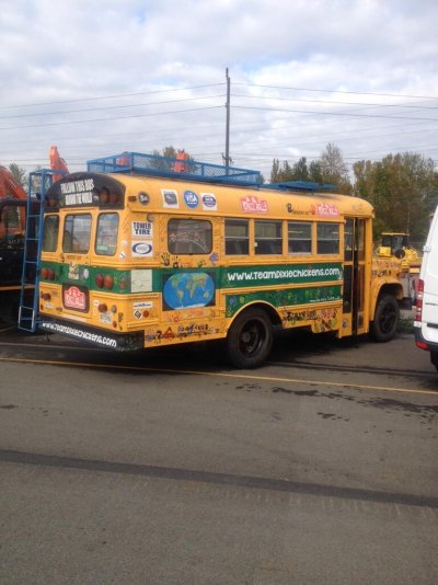
 
Wow, this is great info! Thank you so much! And especially for the map/atlas link. I've been doing a bit of reading, and my library is great for ordering stuff for me as well.

In all honesty, the nature of road trips (and we did 10,000 miles in 34 days) means there is precious little time for exploration. We'd probably spare a day or so in the area, but would need to keep chugging along at our top speed of 50mph in order to make our goal of getting to SC in 4 weeks.

I will put your ideas into my planning document, and hope that we'll be able to check out a few of them. The "roads" in Kazakhstan looked a lot like this in places, so we are sadly familiar with bad roads and being self reliant. And how nice it will be to get answers in English when we ask about road conditions!

Kaz "road" near Aralsk
 

Attachments

  • 2013-07-27 19.37.33.jpg
    2013-07-27 19.37.33.jpg
    849 KB · Views: 5
Heard good things about that device and it is definitely friendly with the Spotwalla site. Here's my latest tinkering with the Spotwalla, but I can't quite get the image I want.
Nice little trip Sarah. Are those green numbers on the Spotwalla image your photo numbers? :)

Probably you won't have time to go down HWY 395 in California before hitting Las Vegas. But if you do you could see the eastern entrance to Yosemite. There are some nice easy high altitude hikes there. If you do and would like suggestions let me know. Mammoth Lakes is a nice stop over down the road from the Tioga entrance to Yosemite.
 
Thanks, Lsbcal! Those are actually the "checkin/Ok" message markers. Every morning I sent one out to let my boss know we were alive!

We've just been asked to be a feature vehicle at this event, Overland Expo - Overland Expo 2014
so that will dictate a bit of our travel plans in May to be sure we can be there for it.

I like the way you say "easy" and "high altitude" hikes in the same sentence. :) As a lifelong sealevel resident, I would be huffing and puffing just standing there! But good info, and I'm plugging it all into our route planning discussions!
 
There is at least one very level hike that goes into Lyle Canyon. The Touloume River runs through it. It is beautiful up there with large granite domes. I've never been there in October but we were there in late August this year.

The drive just up to the Tioga Pass entrance is spectacular, a long gentle upward climb from maybe 6000 ft at Lee Vining to the 10,000 ft level. Yosemite High Sierras at its best with very few people around in October.

There are also other nice walks in the Mammoth Lakes vicinity that do not involve entering Yosemite Park.
 
Back
Top Bottom