Smart phone in lieu of dedicated GPS unit?

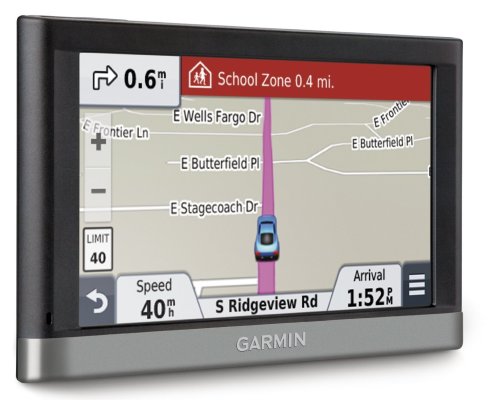
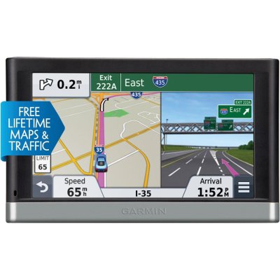
I use an old Garmin, and I prefer that over a phone for safety. I have it on a weighted bean bag that sits on my dash, and it is much easier to use because of where it is located. Also, it enables me to find nearby gas stations, hotels, or food along my route, something I haven't seen mobile phone apps able to do within the GPS app. It is easier as well for being able to set waypoints and easily recall them while driving. Using a dedicated GPS also frees my phone for broadcasting podcasts or music through my car radio, which it can't do if you're using the map feature. Some apps may have evolved around this now, but I'm pretty sure on the iPhone at least, only one app can have control of the speaker at one time. Then of course there is the issue of actually using your phone as a phone and a GPS at the same time, which can be tricky if not completely unsafe. I have 2 problems, and one is that I don't have lifetime maps, and so sometimes if roads have changed, then I'll use the smartphone, but it's not my preferred solution. Also, if driving in congested traffic, the real-time traffic that google maps has is great. You can overcome both of these issues with the right GPS unit. Oh yes, I've used my Garmin in many countries where I didn't have phone service, so that has saved me some $$$.


Sent from my iPad using Tapatalk
 
Last edited:
...Using a dedicated GPS also frees my phone for broadcasting podcasts or music through my car radio, which it can't do if you're using the map feature. Some apps may have evolved around this now, but I'm pretty sure on the iPhone at least, only one app can have control of the speaker at one time.
I haven't encountered that using iPhone 6 Plus and Waze. The music still plays while the Waze voice comes on, but it is slightly muted while the app is speaking.
Also, if driving in congested traffic, the real-time traffic that google maps has is great.
The Waze app far outshines Google maps when it comes to directing me around traffic congestion as it develops. I keep it on "fastest route" and it has a very aggressive algorithm that is light years ahead of anything Google has. I was sold when I used it one day driving back home to downtown from the burbs and it turned an hour drive according to Google into 30 minutes. It took me down streets i didn't even know existed but I didn't run into any traffic at 5pm. Last month I drove from Reagan National to Fairfax VA in the late afternoon - using it side by side with the built in nav unit in my rental it reduced a 45 minute drive according the the car gps into 28 minutes by using a different route.

To be honest, Waze does have an occasional glitch with my current location. Sunday morning my GF and i were going to eat a late breakfast after working out and Waze kept indicating my current location and direction of travel way off from reality. It's not the first time it's happened.
 
Last edited:
Even though we have dedicated nav systems in both cars, we often use our iPhones (Google or Apple maps). I have an old Garmin Nuvi that served us well in previous non-nav cars, but I only it in rental cars when we fly somewhere now. We prefer the smartphone only because the maps are automatically updated unlike the nav ($169 per update, that's nonsense) or handheld GPS unit (free, but ours has to be plugged into a PC for an update).

I've used all 3 options - built in GPS (what I prefer overall), Garmin handheld unit mounted on the windshield, and smartphone. Cost of updating hasn't been an issue.

I have a Ford Explorer (2012) now with built in GPS and periodically I get a flash card with map updates sent to me in the mail. I've never had to ask for it and there has been no charge for it.

On my Garmin, I bought free lifetime updates and it wasn't an outrageous amount of money. So, I was happy with that as well.
 
I used Google Maps on my Ting-connected android phone just a couple of hours ago to navigate from the airport to my hotel. I usually keep data turned off, but I turn it on specifically to do navigation. I have an air-conditioner vent-mounted holder that works well in most rental cars.

Google Maps works really well in most civilized places. It has made some spurious recommendations, like repeated exit-reenter the Ventura Freeway on the way to Santa Barbara, and what looked like a location-bombed Bubba Burgers on Kauai. Today, I tried Maps on the work Blackberry; it couldn't even find my local hotel, so back to Google. We just bought a car with the GPS app; it already needs updating. Somewhere in the 1.5" thick manual it'll tell me how to do that; every time I use Google Maps, the information is current without fuss.
 
I have a tom-tom that I've used in Sicily (better maps than Garmin, for Sicily, at the time I purchased it.) We've used it around home and on domestic vacations as well. It works fine. We did not bring it on our current Europe trip because we were mostly doing public transit... and hopefully the trains and buses know where they are going. LOL.

This week is the only week we're renting a car - to explore in/around Aix-en-Provence. The car came with built in navigation. We were using it yesterday and discovered it had significant lag in the turn by turn directions - telling us AFTER the exit that it was time to exit. Fortunately, I had my Nexus 5 - and we switched to using that.... MUCH better. But - we missed a critical turn in near the port in Marseilles yesterday before we learned our lesson and ended up these very narrow, windy streets, 1 car wide, but bidirectional, full of blind corners because the built in GPS lagged.

Because of this experience, I'm not a fan of the built in gps of the Peugot 308.

We'll have my phone with us when we head out this morning.
 
I repurposed my old garminfone which incorporated a complete Garmin GPS with lifetime maps as a standalone GPS unit for use in rental cars. I like the Garmin display which includes information like instantaneous speed along with speed limits. Your speed info turns red when the speed limit is exceeded. The speed limit info is quite accurate and extends now to my jaunts into Canada. Another thing I love is that the Garmin retains your traveled route as a blue line so when returning to your starting location, you don't need new instructions, you can just backtrack.
 
I will say one thing about Google Maps on phones though. When you get into a big interchange where different lanes go in different directions, Google Maps didn't sort it out too well or give enough warning ahead of time.

I think Garmin advertises something like Lane Assist feature that may be better.

But I haven't been taking my Garmin on overseas trips for a few years now.
 
We use phone for turn by turn directions.

I must say I sue the nav in the vehicles a lot. Mostly just to bring up a map and see if a particular road goes through when I hit traffic or if we are just out exploring. I have also found that thee map cd's come down over time if you ignore them long enough.
 
I think Garmin advertises something like Lane Assist feature that may be better.

Lane assist is a great feature when you are in big cities or complicated highways:

lane assist.jpg
 
+1 on Waze, I use it exclusively retired the TomTom unit. (BTW Google owns Waze)
 
Any idea whether mounting it over the tachometer (what I do) is legal or not? I can still see spedometer, gas gauge, etc., just not the tach.
 
Any idea whether mounting it over the tachometer (what I do) is legal or not? I can still see spedometer, gas gauge, etc., just not the tach.

The issue of where you can legally mount as GPS/cell phone varies by state and there is no real rule of thumb that I can find.

That said, it is illegal to mount a gps on the windshield in some states. However I don't believe any state has a law prohibiting mounting these devices on the dash - although some specify dash mounting cannot interfere with the deployment of air bags.

Traffic Talk: Where can a GPS navigation device be placed in a vehicle? | MLive.com

I don't see any issue with mounting it over the tach - but note I'm no lawyer and didn't stay in a Holiday Inn Express last night...
 
Any idea whether mounting it over the tachometer (what I do) is legal or not? I can still see spedometer, gas gauge, etc., just not the tach.

My understanding is mounting a GPS on the dash is legal in all states but I'm not 100% sure.
 
I doubt people get caught that much.

There are so many other things a cop is looking for before looking to see if you have a GPS on the windshield.

Might not be good if you're pulled over for something else or if you have it parked -- if you would even leave a GPS in a parked car.
 
That is one reason that I like having it on the instrument cluster where the tach is. On the window or top of the dash it is more noticeable to thieves, whereas where i put it it is not very noticeable unless someone is looking closely.
 
So I just received my new Garmin 2597LMT and took it for a spin. It seems nice except the color saturation looks very faded compared to my old 255W. This makes it hard to read 'on the fly' in bright sunlight.:(

I like the lane assist, LMT updates, junction view, and current street shown on bottom of screen.

As I can still return/exchange it, does someone have a similar unit with good color saturation they can recommend?

omni
 
I have that exact unit, bought about a year and a half ago. Color saturation is fine for me, and it has worked very well on many trips. Granted, if bright sun is hitting the screen directly it washes out, but that's a rare occurrence sitting on my dashboard. I would look at one in a local store to find out if it's just the one you got or if they are all the same.
 
Before premium smart phones with IPS and "retina" displays, the Garmins and TomToms probably looked okay to people.

Now they look poor in comparison to phones which use much better displays and other components.
 
I have that exact unit, bought about a year and a half ago. Color saturation is fine for me, and it has worked very well on many trips. Granted, if bright sun is hitting the screen directly it washes out, but that's a rare occurrence sitting on my dashboard. I would look at one in a local store to find out if it's just the one you got or if they are all the same.

I have the 2595LMT and it is fine as well.
 
I use the Garmin app for IOS that includes having the maps loaded on the iPhone. It's mounted in a cradle on the dash in front of me, within easy reach. Works great, has the same format as my old Nuvi (which I like) and can give directions through the bluetooth speaker that also serves as a handsfree phone and can play media over FM for entertainment. Purchasing the app also gives me map updates at no additional cost. All in all, very happy with a single device serving all those functions.
 
Issue with 2597LMT color saturation

Here are 2 images from Amazon.com for the 2597LMT.

The bland gray one (if you replace that red bar across the top with a light gray bar) looks like what I see on my new 2597LMT.

So, basically, it's a sea of gray, which makes it difficult to absorb info while driving at a quick glance since it all sort of runs together.

Perhaps there's a setting I've missed. Does anyone know if there's some way to make my unit's display look like the colorful one below?

omni
 

Attachments

  • 2597LMT my ususal.jpg
    2597LMT my ususal.jpg
    173.4 KB · Views: 7
  • 2597LMT colorful.jpg
    2597LMT colorful.jpg
    163.3 KB · Views: 7
Updating

As I understand it, some (most?) smart-phone GPS apps will need a data connection to do turn-by-turn navigation, or to recalculate a route (they access the computers in the cloud to figure that out). The GPS alone can show you where you are though. And NW-Bound showed how to cache a map.

But apps like OSM, Co-Pilot (mentioned below), and maybe a few others run the phone just like a GPS with no cell connection. Full turn-by-turn, route re-calc, etc.

-ERD50

We spent the weekend in the city and at near last minute, I was looking to update the off-line google maps on my tablet (a cheap Acer that has built in GPS), so I could use that if we needed (I found out that my old stand-alone GPS battery has died, can only use it in the car).

Using Google maps off-line is tedious, so I googled for suggestions, and found a lot of people recommending a Nokia app "Here", for off-line maps and navigation. Minutes before we left, I downloaded it and an Illinois map (all free), and had almost no time to read up on it, and I got it doing all I needed w/o too much head scratching. Overall, I was very impressed. It's fast, and has all sorts of info in the map file. I was able to find all the restaurants and other places we were looking for w/o a data connection at all.

I need to invest a little time reading up on it, but so far, much easier to use than the OSMand app (Open Street Maps and Navigation) I had tried.

iOS and Android:

https://pages.here.com/app/#

I just saw that another poster ( Nunthewiser ) mentioned "Here" (an unfortunate app name, too common to google/search - surprised they didn't think of that).

http://www.early-retirement.org/forums/f27/which-gps-to-buy-79345.html#post1653109

-ERD50
 
Last edited:
Back
Top Bottom