The Northern California Fires

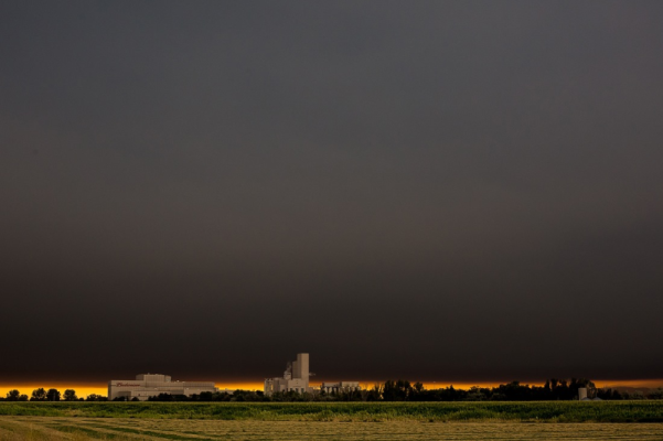
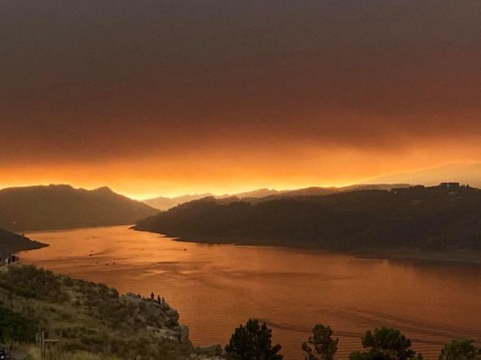
Even here in the midwest, we get weird looking sunsets due to smoke. Some days are better than others, but there is an odd look to the sky even at midday. Hope all of our members stay safe.
 
Yuck!

I remember flying into Seattle in 2018 and it was their worst smoke day yet. From the airplane the entire state was covered by a blanket of brown smoke with a couple of volcanos peaking out. It smelled quite bad in the city and the next day there was no visibility across the Sound.

Fortunately for us heading to the beautiful San Juans it cleared in 2 days.
 
Living in Reno the last few years have been awful during fire season. Placerville is a beautiful area where we go every fall as is Chester and the Lake Almanor areas. I hope Skip is fine. Frequently my car has ash on it and I check the air quality frequently to see if I am able to take a walk. I have lived in 5 states and everywhere has weather issues.
 
Yuck!

I remember flying into Seattle in 2018 and it was their worst smoke day yet. From the airplane the entire state was covered by a blanket of brown smoke with a couple of volcanos peaking out. It smelled quite bad in the city and the next day there was no visibility across the Sound.

Fortunately for us heading to the beautiful San Juans it cleared in 2 days.

This so reminds me of flying into and out of Pittsburg on a j*b interview ca. 1970. There was a blueish pall of industrial smoke for almost 50 miles around the city. I believe that has all been cleaned up now, but I decided I wanted no part of that region of the country. Who knew we'd cover the bulk of our country (and Canada - sorry about that) with smoke from forest fires. Time to deal with this issue. Wish I had an answer. YMMV
 
. Who knew we'd cover the bulk of our country (and Canada - sorry about that) with smoke from forest fires. Time to deal with this issue. Wish I had an answer. YMMV

Hey, I love Canada and the Canadians, but there is no reason to apologize to them. A lot of that smoke in the USA comes from forest fires in B.C. and Alberta. For some reason smoke just doesn't respect our man made borders.
 
If skipro is in the area close to the wine region of Fairplay/Somerset, they were under mandatory evacuation, as well as parts of El Dorado county. The winds have been keeping the growth to the east, vs. the larger population centers to the west (as well as the vineyards). Of all the current fires, this one has had the most impact to people.
 
If skipro is in the area close to the wine region of Fairplay/Somerset, they were under mandatory evacuation, as well as parts of El Dorado county. The winds have been keeping the growth to the east, vs. the larger population centers to the west (as well as the vineyards). Of all the current fires, this one has had the most impact to people.

I think he is southeast of Placerville. The area you describe is under evacuation warning, which could escalate to a full evacuation, depending on the wind.
https://www.google.com/maps/@38.632...4m3!15m2!1m1!1s/g/11rwptxy0p?hl=en&authuser=0

https://www.fire.ca.gov/incidents/2021/8/14/caldor-fire/
 
I think he is southeast of Placerville. The area you describe is under evacuation warning, which could escalate to a full evacuation, depending on the wind.
https://www.google.com/maps/@38.632...4m3!15m2!1m1!1s/g/11rwptxy0p?hl=en&authuser=0

https://www.fire.ca.gov/incidents/2021/8/14/caldor-fire/

That mandatory area and evacuation warning area are at the edge of the that area. Some are under mandatory orders, so are not (roughly near Perry Creek and Omo Ranch Rd). The manager of the tasting room I belong to lost her home in nearby Grizzly Flats. Friends of my spouse saw the remains of their weekend home on the news.
https://www.fire.ca.gov/incidents/2021/8/14/caldor-fire/

That area is southeast of Placerville. Most of the area was still under voluntary orders, but the further east you hit the mandatory line (see link above, same as the 2nd one you had also linked). Highway 50 was shut down to Tahoe but the winds are shifting south in the latest update.
 
fire.airnow.gov is the website I live by these days. I check it first thing every morning, and several times a day to know just how high to set the air purifiers. Every morning I hope the winds have changed, but this last week has been ROUGH. So cooped up and stuck inside, no fun.
 
fire.airnow.gov is the website I live by these days. I check it first thing every morning, and several times a day to know just how high to set the air purifiers. Every morning I hope the winds have changed, but this last week has been ROUGH. So cooped up and stuck inside, no fun.


Agreed!
The smoke wasn’t as bad in my area yesterday so I sat outside for a while. Actually saw some blue sky poke through.
We’ve been fortunate here that this past week was really the first smoky days.
I’m in a low fire risk county and these past 2 years have been the worst for smoky air.
I fear it will get worse over time.
 
fire.airnow.gov is the website I live by these days.
That site is great to see where the smoke is coming from. I also like https://www.purpleair.com/map -- no data on smoke plumes, but it's a bit lighter-weight interface.

Fortunately we've had no major fires this year in Colorado, so far. Last year wasn't as good. These pix were both taken just about a year ago, both right around NOON, within a few miles of my house. It was supposed to be 90°F the day of the first picture, but at my house (under the smoke plume) it was 62. 5 miles away, out from under the smoke, it was 87.

It's oppressive when it's like that. You can't breathe, and it never gets properly light...
 

Attachments

  • SmokeBrewery.png
    SmokeBrewery.png
    296.6 KB · Views: 40
  • HorsetoothSmoke.jpg
    HorsetoothSmoke.jpg
    72.9 KB · Views: 39
Last edited:
This was taken just before we evacuated our home. The fire was on top of the mountain a mile and a half from our home
 

Attachments

  • IMG_6971.jpg
    IMG_6971.jpg
    337 KB · Views: 36
This was taken just before we evacuated our home. The fire was on top of the mountain a mile and a half from our home
Hope you are well and safe Souschef. We had to do the same here in SW Oregon 3 years ago. The forest fire came within feet of our house. The firefighters were able to stop it by bulldozing a fire line right behind our house and using water cannons to put out the large pines nearest our house. Best luck to you.
 
This was taken just before we evacuated our home. The fire was on top of the mountain a mile and a half from our home

Wow! Please keep us informed and wish you the best.
 
We are back home and safe, thank you all.The wind pushed the fire away from us along the top of the ridge
 
  • Like
Reactions: W2R
We are back home and safe, thank you all.The wind pushed the fire away from us along the top of the ridge

Thank goodness!!! Great news!
 
We are back home and safe, thank you all.The wind pushed the fire away from us along the top of the ridge

Wow. That is scary stuff.

I had a tornado through my front 6 one year and one through my back 40 the next. I think fire would frighten me more. Glad the winds cooperated!
 
So glad you are back home. Having a fire that close is really scary.
 
Still no word or activity from SkiPro33. Cal Fire has started to repopulate some of the evacuation areas on the west side of the fire line. Hopefully he’ll get back in his home soon and let us know he’s okay.
 
Wow. Between storms, forest fires and health issues, we have a lot of members in peril. As Tiny Tim would say "God bless us, everyone."
 
Back
Top Bottom