Poll: Google, Tom-Tom, Apple, Waze?

Which GPS map do you prefer?

  • Google

    Votes: 69 58.0%
  • Apple

    Votes: 17 14.3%
  • Waze

    Votes: 29 24.4%
  • Tom-Tom

    Votes: 2 1.7%
  • Garmin

    Votes: 12 10.1%
  • Paper

    Votes: 4 3.4%
  • Wife

    Votes: 4 3.4%

  • Total voters
    119
  • Poll closed .
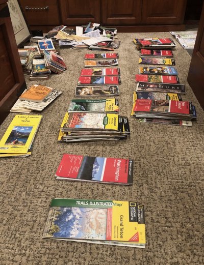
No disrespect intended but - paper maps, wow. I won’t even listen much less write it down if someone tries to give me directions to anywhere, I just ask “all I want is the address.” That’s all you need 99.9% of the time, IME it’s very rare when GPS can’t find an address (even though the route might not be the optimal).

Effectively all of the surface of the surface of the Earth doesn't have a traditional address one can input to a GPS (aside from lat/long, of course, or newer technologies such as Three Words, etc.), and places like that aren't of much interest to me.

I rather hike the Camino de Santiago or Dolomites, both of which we have done, then get in a car and go to "an address."
 
Last edited:
Effectively all of the surface of the surface of the Earth doesn't have a traditional address one can input to a GPS (aside from lat/long, of course, or newer technologies such as Three Words, etc.), and places like that aren't of much interest to me.

I rather hike the Camino de Santiago or Dolomites, both of which we have done, then get in a car and go to "an address."
Glad you like hiking but that’s not what this thread is about - NAV for a Subaru Outback, where addresses is likely all the OP will need. I used (Lat Lon) waypoints for 25 years boating, that’s not what this thread is about...
 
I remember trying Waze, and the first time I was driving it kept telling me that I was speeding. I tended to go about 5 over (less so these days), and when not on cruise it's really easy to go from 3 to 7 over, and Waze would beep every time. I found how to shut it off, but it annoyed me that trip that the default would be so distracting. I don't recall if there were other issues, but I gave up on Waze and didn't even put it on my most current phone.

Google is just so ubiquitous that it's so easy to use. Many businesses use a google map. If I've looked at it, or entered a location on my laptop just to get an idea of the overall map and how long it will take, when I open maps on my phone the address is right there as a top suggestion so I don't have to type it in.

I also like using My Maps in google. I put a lot of hiking trails on it, and tag parking areas, so I can use google to drive to the trail head.

I did run into a bad maps choice last winter in Vermont. Our airbnb host suggested directions from Albany. We followed them, and the roads were all good. On the way back, we used Google Maps, and it had us on a bunch of back roads. All paved, but many so narrow they didn't have a center line. It definitely was not a quicker route, and was a tougher drive. So if someone tells me to use these directions rather than google, I listen.
 
I remember trying Waze, and the first time I was driving it kept telling me that I was speeding.

You can tell it how much over the limit you have to be doing before it warns you. I typically use 10 mph. In Europe the speed cameras are usually very strict so I use actual speed over there.
 
Glad you like hiking but that’s not what this thread is about - NAV for a Subaru Outback, where addresses is likely all the OP will need. I used (Lat Lon) waypoints for 25 years boating, that’s not what this thread is about...

Ouch

I won’t be back here again.

This thread is actually a metaphor for a GPS: a small box that narrows one’s options and perspectives, while facilitating anonymous insults.

Over and out.

I’m off to live in the real world.
 
Glad you like hiking but that’s not what this thread is about.

The thread, according to the OP, is about "your preference(s) for a gps map program". Usage in a vehicle is an example. Let's try a little tolerance, shall we?
 
I just use Google maps for everything. I would never bother with a built in GPS again.

Last year we went to Yellowstone for the first time; the car had a built in GPS. When we entered the park, DH asked me to enter the hotel's address into it.

Um... I said... there isn't one. It's the Lake Hotel, Yellowstone park. Just follow the loop and we'll know it when we see it.

He looked at me like I was insane, and I just had to tell him to trust me just keep going and we'll get there. (we did)
 
One point mentioned but IMO not emphasized enough is "Where is the database?"

If it's in the cloud, then maps are downloaded as needed IF cell data is available. On long road trips off interstate highways that may not always be the case. Even near interstates that may not always be the case. I was in Tomah, WI a few years ago using an MVNO connecting to the AT&T network and had no coverage. Two interstates intersect at Tomah.

...

Our second choice GPS is Google, primarily for the traffic information. Where we're concerned about traffic we are in a city, so cell data is pretty much available. CoPilot has a traffic option, too, but there is some kind of fee.

So ... IMO the location of the database should be considered versus someone's use case for the GPS. Tradeoffs will differ.

You don't have to rely on your mobile data if you don't want to as you can download map data on Google Maps for the entire world if you like..but I would think it might take a little while and could take up a bunch of storage on your phone. On longer trips or going overseas, I always download them before I go...and it works like a champ.
 
I use an on-dash Garmin while driving and if necessary Apple Maps to walk to the final destination.

I also keep a paper state map in the glove compartment for, well, just in case...
 
I voted for Waze as Google here doesn't note police presence yet but there are still some features in Google that I prefer.
 
I use Google Maps, it drains my phone down at 1/3 the rate that Waze does. Also, I had an "exciting" time using Waze in the Middle East, I could not get it to speak nor show the street names in English; Google Maps did not have that problem.

I am a big paper map person so I still keep a Rand McNally road atlas around.

DW uses a Garmin, she does not mix well with cell phone apps or paper maps :) . A dedicated GPS for driving works for her.
 
I like to keep the voice turned off most of the time.

Apple Maps works with my Apple Watch to tap me on the wrist as I come up to each turn or exit ramp. This is perfect to help me not miss a turn without having to listen to the voice instructions.

I do usually leave the voice instruction on when I'm driving in unfamiliar territory.
 
I use Apple Maps now. They have gotten good enough to be very reliable. I really like to navigate by my phone because it goes to my watch and taps me on the wrist at critical points as well as having verbal instructions from the phone. Makes hands-free, display-free navigation very easy. I can quickly glance at my watch for next turn information.

Oh, wow - mpierce posted same already.

We dumped our Garmins long ago.
 
Last edited:
You don't have to rely on your mobile data if you don't want to as you can download map data on Google Maps for the entire world if you like..but I would think it might take a little while and could take up a bunch of storage on your phone. On longer trips or going overseas, I always download them before I go...and it works like a champ.
Oooh, thanks for reminding me! I replaced my phone recently, so I need to re-download the maps for the places I visit (during non-pandemic times)! :D
 
I voted for Waze as Google here doesn't note police presence yet but there are still some features in Google that I prefer.

The Google Maps I use has this feature. Allows you to see speed traps and report them.
 
I voted for Waze as Google here doesn't note police presence yet but there are still some features in Google that I prefer.
Funny in that Google bought Waze in 2013, but I agree Waze provides more info. I assumed Google would merge the two eventually.
The Main Differences Between Google Maps and Waze

While both apps offer turn by turn directions, there are a few key differences between Google Maps and Waze:
  • Waze is community-based, Google Maps is more data-based.
  • Waze is pretty much just for cars, Google Maps offers walking, driving, biking, and public transportation directions. They also have built-in “Explore” features that allow users to see events, reviews, photos, points of interest, etc. There’s even the “street view” mode to see things at street level.
  • Waze requires a data connection, Google Maps is available offline.
  • Google Maps includes business data such as menus, hours, and phone numbers, while Waze does not.
  • Waze offers real-time info such as road closures, road hazards, traffic alerts and real-time traffic conditions based on driver data. Google Maps has only started to include some of these features recently.
  • Google Maps uses a traditional navigation interface, while Waze offers a sleek and minimal interface using the latest in design language.
  • Google Maps is fairly basic, Waze offers a high level of customization (including celebrity voices!)
In short, Google Maps is a simple but powerful navigation tool that selects the quickest and most efficient route.

Waze collects data from a bunch of different users and leverages that data to tailor your trip experience, giving you the most efficient route that’s free of obstacles and other nuisances.
 
Last edited:
I love paper maps. Just like I love the feel of paper (news)papers. I mean they're more foldable than phones and tablets. Another good thing about paper papers are that they force me to get semi-dressed to go out and retrieve them. We don't have a dog.
 
Although paper maps are the best, sometimes it takes a while to find the one I need.
 

Attachments

  • IMG_2676.JPG
    IMG_2676.JPG
    871.3 KB · Views: 14
A couple of more things regarding Apple Maps.

While you don't manually "download map data" before hand, Apple Maps does load map data along your route when you setup the route so that if you are out of cell coverage (hopefully briefly) it'll have map data to show you.

Another feature I enjoy is that it knows where you parked your car. This makes it easy to have it lead you back to your car in a parking lot or in a city where you parked it.

Since Apple Maps also knows the trails in our local metro parks, when I'm hiking it's sometimes useful to ask "Siri take me back to my car" and it'll route me back using the trails. It'll even tap me on the wrist to tell me to take the left or right fork in the trail.

I also like that Apple doesn't track your location and routing information. They list the various things on their privacy webpage: https://www.apple.com/privacy/features/

For example "data that is sent from your device to the Maps service is associated with random identifiers so Apple doesn’t have a profile of your movements and searches"
 
A couple of more things regarding Apple Maps.

While you don't manually "download map data" before hand, Apple Maps does load map data along your route when you setup the route so that if you are out of cell coverage (hopefully briefly) it'll have map data to show you.

Another feature I enjoy is that it knows where you parked your car. This makes it easy to have it lead you back to your car in a parking lot or in a city where you parked it.


I still have a preference for Google, but Apple is catching up quickly.
 
Speaking of addresses and digital maps, for 10 years after I bought my high-country boondocks home, no digital maps had our address. A friend of mine from out-of-state was going to visit us up there. I sent him an email with driving direction, telling him that we were not on the map. He ignored my email, and did not even try to pre-enter my address to his digital map of choice to see if it came up.

Of course, he discovered that when trying to find my place, had to call me for vocal guidance as he probably already deleted my email. Dumb. I should have given him a hard time, but decided to let it go.

PS. A neighbor in the subdivision down the bumpy and rocky road called the county to complain about the road not being maintained. The transportation department told him their record showed that the division and road had been abandoned. Funny! They never failed to send out tax bills, though it took them a year or two to update my tax record status from an empty lot to one with a house on it.


PPS. Although the subdivision existed a few decades ago (the roads all show up on all digital maps as they were already entered in county records), the satellite photos of the area looked like they were low-res products of the 70s or 80s. One day a few years ago, suddenly I saw my home on good resolution Google Map screen. Google Streetview however still does not show my home. The guy driving Google Streetview camera car decided to turn back a few hundred feet before reaching my home. Probably thought there were no more houses down the rocky road, or the road was about to end.
 
Last edited:
For road trips, either here in the US or in Europe, Google Map is my tool of choice, mainly due to its StreetView. It gives me a preview of the places where I will spend the night, or park my motorhome.

In Europe, it allows me to preplan down to the minute details of how to find a spot to park the car, although it often cannot help me find the Airbnbs in rural medieval towns.

In Alaska, Google Streetview even often let one find places for RV boondocking along the road, yet Google Streetview does not have my high-country home as mentioned earlier.

I found it most impressive when Google Streetview covers to the end of the Dempster Highway in Alaska at Inuvik. At the end of the road when the Google camera car did a U-turn, it captured the image of another Google car behind it. It showed they traveled in a pair up there in case of road trouble. Very cool.

Canadian government has extended the Dempster road all the way from Inuvik to reach the Arctic Ocean at Tuktoyaktuk, but I just looked and Google has not yet covered this new segment.
 
Last edited:
In 2017, Google Map in Europe did not have lane info for freeways. This is a serious deficiency, because without knowing how many lanes went left or right at freeway junctions I had to change lanes to go all the way to the leftmost or rightmost lane to be sure that I would be able to make the transition.

On busy European freeways, changing even one lane was tough enough, let alone swinging all the way from one side to the other. By the time I saw the overhead signs that had the lane info, I often had little time to change multiple lanes to be on the right one.

In 2019, I was pleased to see that it now had lane info. This improvement was tremendous.
 
Last edited:
Google Map also has Streetview of Nome Alaska. Now, there's no road linking Nome to Fairbanks which is 500 miles away. People travel to Nome via airplane.

So, does Google put a camera car on a boat to take it to Nome, which is a port?

No, they sent a guy who walked the town. :) See his shadow in the captured Streetview below. You can see his mitts.

https://goo.gl/maps/gapAT8Q9D4WgQEht9
 
Last edited:
Back
Top Bottom